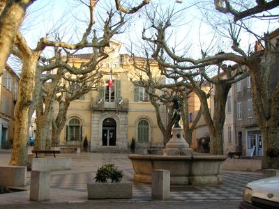
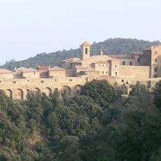
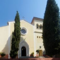
Collobrières, Medieval commune in Var, France
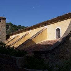
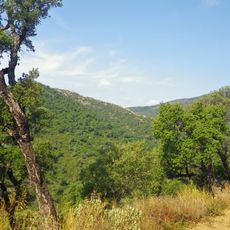
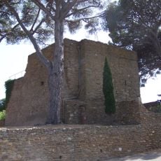
Collobrières is a commune set among oak and chestnut forests in the Maures mountains, with narrow cobblestone streets winding past traditional stone buildings. The layout preserves the way buildings cluster together within this forested terrain.
In the 19th century, the settlement became a central hub for cork production using bark from extensive oak forests in the area. This industry shaped economic life and the character of the place for generations.
The town celebrates its chestnut heritage through a festival each October where local producers and craftspeople gather to showcase their work. You can watch how residents continue to honor this ingredient that has shaped life here.
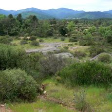
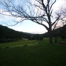
You can explore the area on three marked trails of different lengths, ranging from shorter botanical paths to longer routes through forests. The walks offer ways to see both the oak and chestnut groves depending on your time and interest.
A small confectionery workshop operating since 1945 produces candied chestnuts using traditional methods and locally sourced nuts. The business demonstrates how old craft techniques have survived and continue in this region.
Location: canton of Collobrières
Location: Var
Location: arrondissement of Toulon
Elevation above the sea: 353 m
Shares border with: Bormes-les-Mimosas, La Garde-Freinet, Gonfaron, Grimaud, La Londe-les-Maures, Les Mayons, La Môle, Pierrefeu-du-Var, Pignans, Puget-Ville
Phone: +33494138383
Email: dgs@collobrieres.fr
Website: http://collobrieres.fr
GPS coordinates: 43.23722,6.30889
Latest update: December 7, 2025 19:27
Chartreuse de la Verne
7.5 km
Chapelle Notre-Dame des Anges
5.1 km
Château Aurélien de Fréjus
11.3 km
Circuit du Luc
12.5 km
Église Saint-Trophyme de Bormes-les-Mimosas
9.9 km
Signal de la Sauvette
4.9 km
Gaoutabry dolmen
9.2 km
Menhirs de la Ferme Lambert
3.3 km
Chapelle Saint-François-de-Paule de Bormes-les-Mimosas
10 km
Arboretum de Gratteloup
6.9 km
Église Saint-Louis du Lavandou
12.1 km
Plage de Saint-Clair
12.2 km
Plage de Jean Blanc
12.9 km
Plage d'Aiguebelle
12.4 km
Plage du Rossignol
13.4 km
Plage du Layet
13.4 km
Chapelle Sainte-Magdeleine de La Môle
13.3 km
Église Saint-Pons
215 m
Pignans collegiate church
9.7 km
Église Sainte-Marie-Madeleine de La Môle
13.1 km
Golf de Valcros
7 km
Château des seigneurs de Fos
9.8 km
Arboretum Du Treps
322 m
Église Notre-Dame de-l'Immaculée-Conception de Gonfaron
9.3 km
Plage de l'Eléphant
13.1 km
Chapelle Saint-Clair du Lavandou
11.8 km
Chapelle Notre-Dame-de-Pitié de Collobrières
123 m
Crique du Layet
13.4 kmVisited this place? Tap the stars to rate it and share your experience / photos with the community! Try now! You can cancel it anytime.
Discover hidden gems everywhere you go!
From secret cafés to breathtaking viewpoints, skip the crowded tourist spots and find places that match your style. Our app makes it easy with voice search, smart filtering, route optimization, and insider tips from travelers worldwide. Download now for the complete mobile experience.
A unique approach to discovering new places❞
— Le Figaro
All the places worth exploring❞
— France Info
A tailor-made excursion in just a few clicks❞
— 20 Minutes