Autrans

Log in to your account

AroundUs is a community-driven map of interesting places, built by curious explorers like you. It grows with every review, story, and photo you share.
Connect to save your favorite spots, contribute locations, and create personalized routes.
By continuing, you accept our Terms and Conditions and our Privacy Policy
Add to collection
Map
Suggest a change
Share

Autrans, former commune in Isère, France

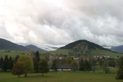
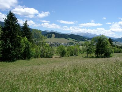
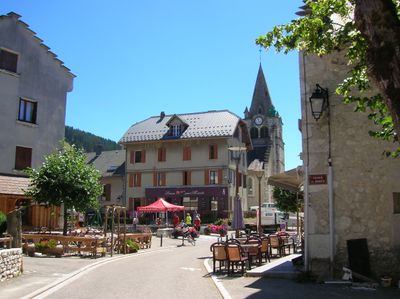
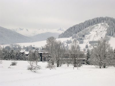
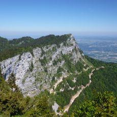
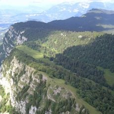
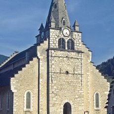
Autrans is a small village on the Vercors Plateau, surrounded by forested hills and mountain slopes that reach above 1,000 meters (3,300 feet) elevation. Traditional stone houses with painted shutters and narrow streets form the quiet village center, while the surrounding landscape features meadows, streams, and dense woodland.

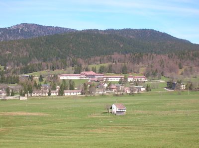
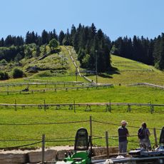
The village originated as a farming community with stone farmhouses and barns that remain visible today as reminders of its rural past. During the 1968 Winter Olympics held in Grenoble, Autrans hosted ski jumping competitions on its slopes, establishing its significance in winter sports history.

The village maintains strong ties to traditional cheese-making and seasonal celebrations that bring the community together throughout the year. You can witness locals gathering at the weekly market and participating in festivals that reflect their deep connection to the land and to each other.

The village is accessible via a mountain road connected to the main network, with regular bus services providing straightforward access for visitors. During winter months, shuttle buses transport people directly from accommodations to the ski slopes, making it easy to enjoy winter activities without extra logistics.

The village hosts the Foulée Blanche, an annual cross-country skiing race that draws thousands of participants and stands as the signature winter event of the region. Additionally, Autrans regularly holds an international gathering where people from around the world discuss technology and future developments.

Location: canton of Villard-de-Lans

Location: Isère

Location: arrondissement of Grenoble

Elevation above the sea: 1,711 m

Shares border with: Montaud, Veurey-Voroize, Engins, Lans-en-Vercors, Autrans-Méaudre-en-Vercors, Noyarey, La Rivière, Saint-Gervais, Méaudre

Website: http://autrans.fr

GPS coordinates: 45.17500,5.54222

Latest update: December 15, 2025 16:04

Photos
The most beautiful places to visit in France in winter: Chamonix, Kaysersberg, Annecy, Lac Blanc, Strasbourg

Winter changes France. The Alps are covered with snow, villages light up their holiday decorations, and the coasts look wild under the grey sky. This collection includes places worth visiting during this season: the peaks around Chamonix and Courchevel, Annecy Lake which freezes some years, the...

Reviews

Visited this place? Tap the stars to rate it and share your experience / photos with the community! Try now! You can cancel it anytime.

« Autrans - former commune in Isère, France » is provided by Around Us (aroundus.com). Images and texts are derived from Wikimedia project under a Creative Commons license. You are allowed to copy, distribute, and modify copies of this page, under the conditions set by the license, as long as this note is clearly visible.

Discover hidden gems everywhere you go!

From secret cafés to breathtaking viewpoints, skip the crowded tourist spots and find places that match your style. Our app makes it easy with voice search, smart filtering, route optimization, and insider tips from travelers worldwide. Download now for the complete mobile experience.

Around Us App Screenshot

A unique approach to discovering new places

Le Figaro

All the places worth exploring

France Info

A tailor-made excursion in just a few clicks

20 Minutes