Enable Location

We need your location to show you interesting places around you

Discover nearby places

Find interesting locations and hidden gems around you

Precise directions

Get accurate directions and distances to places

Your location is never shared with other users. It's only used when you tap the location button.

Puy de Sancy

Log in to your account

Start exploring — it's free

Trusted by 61,909 travelers worldwide

Continue with Google
Continue with Apple
or

We will send you a code to connect

By continuing, you accept our Terms and Conditions and our Privacy Policy

Check your inbox

We've sent a pincode in your inbox. Please enter the code below.

Puy de Sancy

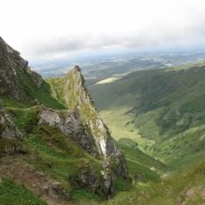
Puy de Sancy, Volcanic peak at Massif Central, France.

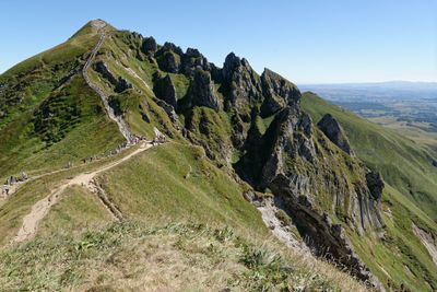
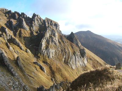
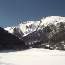
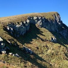
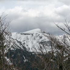
Puy de Sancy is an extinct volcano in Auvergne rising 1,885 meters above sea level, surrounded by four valleys that radiate from its slopes. The sides are covered with grassland and volcanic rock, while the summit area appears bare and windswept.

Volcanic activity shaped the mountain over several million years until eruptions ceased around 250,000 years ago. Shepherds used the summer pastures on its slopes as early as medieval times, and religious processions brought pilgrims to the summit.

The mountain takes its name from Latin „cinctus

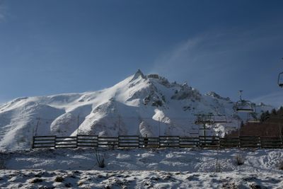
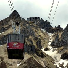
A chairlift carries visitors up to 1,780 meters (about 5,840 feet), from where a broad path leads to the viewing platform in around twenty minutes. The summit is clearly visible in fair weather, but fog and wind can reduce visibility considerably.

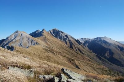
The Dore and the Dogne both rise on the mountain slopes and merge a few kilometers away to form the Dordogne, one of the longest rivers in France. Paragliders regularly use the updrafts at the summit for flights over the valleys.

The community of curious travelers

AroundUs brings together thousands of curated places, local tips, and hidden gems, enriched daily by 60,000 contributors worldwide.

Start exploring
Location
Location
Location
Elevation above the sea
1,885 m
Address
Puy de Sancy, 63680 Mont-Dore, France
GPS coordinates
45.52824,2.81401
Latest update
December 15, 2025 15:53
Natural and cultural spots in Auvergne-Rhône-Alpes

The Auvergne-Rhône-Alpes region offers a mix of nature and history. Walking paths lead through valleys and past waterfalls, while medieval castles stand on hilltops and ridges. Volcanic peaks rise from the landscape, and caves open into the earth below. You will find the Massif Central, alpine...

The most beautiful places to visit in France in winter

Winter changes France. The Alps are covered with snow, villages light up their holiday decorations, and the coasts look wild under the grey sky. This collection includes places worth visiting during this season: the peaks around Chamonix and Courchevel, Annecy Lake which freezes some years, the...

« Puy de Sancy - Volcanic peak at Massif Central, France » is provided by Around Us (aroundus.com). Images and texts are derived from Wikimedia project under a Creative Commons license. You are allowed to copy, distribute, and modify copies of this page, under the conditions set by the license, as long as this note is clearly visible.

Discover hidden gems everywhere you go!

From secret cafés to breathtaking viewpoints, skip the crowded tourist spots and find places that match your style. Our app makes it easy with voice search, smart filtering, route optimization, and insider tips from travelers worldwide. Download now for the complete mobile experience.

Around Us App Screenshot

A unique approach to discovering new places

Le Figaro

All the places worth exploring

France Info

A tailor-made excursion in just a few clicks

20 Minutes

Around Us
Travel Guide & Maps
Download

Send to your phone

QR Code
1

Open the camera app on your mobile.

2

Point at the QR code with your camera. A notification will appear.

3

Tap the notification to open the link.