Valloire, Mountain resort in Savoie, France
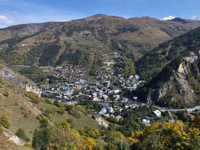
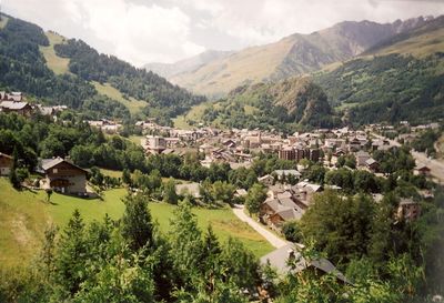
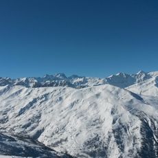
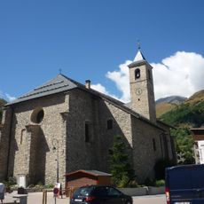
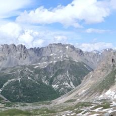
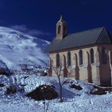
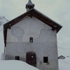
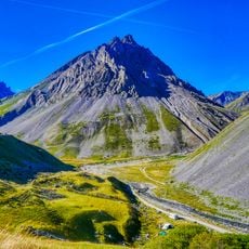
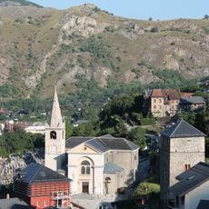
Valloire is a mountain village in Savoie that spans seventeen hamlets distributed between two alpine streams at an elevation of about 1,430 meters. The settlement sits in a valley surrounded by peaks and is naturally organized along the courses of the Valloirette and Neuvachette streams.
Development as a winter destination began in the 1930s when the first ski club was established, launching the construction of hotels and ski infrastructure. This early initiative transformed the remote village into a modern alpine sports center.
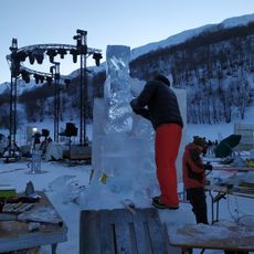
The village hosts an international competition for ice and snow sculptures that began in 1984, drawing artists who transform frozen materials into temporary artworks. This winter festival has established itself as a gathering place for creative practitioners from around the world.
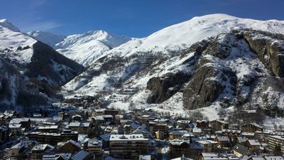
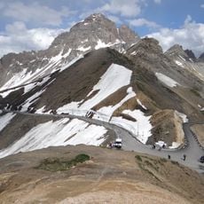
The ski area provides about 150 kilometers of slopes served by 33 lift systems, linked to the neighboring resort of Valmeinier for expanded access. This combined network offers choices for skiers and snowboarders of different skill levels.
The French Foreign Legion operates a mountain training center in Les Verneys where new soldiers learn specialized alpine military techniques. This facility reflects an unexpected military use of the region's terrain.
Location: canton of Saint-Michel-de-Maurienne
Location: Savoie
Location: arrondissement of Saint-Jean-de-Maurienne
Elevation above the sea: 2,215 m
Part of: Galibier-Thabor
Shares border with: La Grave, Le Monêtier-les-Bains, Névache, Albiez-Montrond, Montricher-Albanne, Saint-Jean-d'Arves, Saint-Martin-d'Arc, Saint-Martin-de-la-Porte, Valmeinier
Phone: +33479590311
Email: mairie@valloire.net
Website: http://mairie-valloire.fr
GPS coordinates: 45.16528,6.42833
Latest update: December 14, 2025 20:59
Galibier-Thabor
90 m
Grand Galibier
11.3 km
Fort du Télégraphe
5.3 km
Ouvrage Les Rochilles
10 km
Église de l'Assomption de Valloire
89 m
Château de Saint-Michel-de-Maurienne
7 km
Rochers de la Grande Paré
7.5 km
Montissot
2.9 kmPic de la Moulinière
13 km
Golf des Verneys
2.7 kmWater well, drinking fountain
4.4 km
Bench
829 m
Monument Henri-Desgrange
11.7 km
Chapelle Sainte-Madeleine du Poingt Ravier
648 m
Église Saint-Laurent du Thyl
8.2 km
Chapelle Saint-Pierre de Valloire
881 mAiguille Noire
8.8 kmRoche du Grand Galibier
11.2 km
Église Notre-Dame-des-Neiges de Bonnenuit
5 km
Chapelle Sainte-Marguerite des Granges
1.3 km
Chapelle de la Visitation de Saint-Michel-de-Maurienne
6.9 km
Roche Olvéra
8.3 km
Chapelle Saint-Bernard de la Borgé
472 m
Église Saint-Michel de Saint-Michel-de-Maurienne
7 km
Église Saint-Martin de Saint-Martin-d'Arc
6.2 kmLa Grande Chible
4.6 kmPointe de Pierre Fendue
6 kmMont Touvet
7.2 kmVisited this place? Tap the stars to rate it and share your experience / photos with the community! Try now! You can cancel it anytime.
Discover hidden gems everywhere you go!
From secret cafés to breathtaking viewpoints, skip the crowded tourist spots and find places that match your style. Our app makes it easy with voice search, smart filtering, route optimization, and insider tips from travelers worldwide. Download now for the complete mobile experience.
A unique approach to discovering new places❞
— Le Figaro
All the places worth exploring❞
— France Info
A tailor-made excursion in just a few clicks❞
— 20 Minutes