Côte d'Opale, Coastal region in Pas-de-Calais, France.
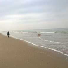
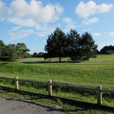
The Côte d'Opale stretches 120 kilometers along the French coast between Belgium and Picardy, taking in white chalk cliffs, dunes, and wide sandy beaches. The shoreline shifts between steep cliffs and shallow bays where the sea retreats far out at low tide.
During World War II, the German army used this coastline as a key position for defense installations along the Atlantic Wall. The strategic location directly opposite England made this stretch one of the most heavily fortified sections of the Channel coast.
Painter Édouard Lévêque gave this coastline its name in 1911, inspired by the way water and sky shift between shades that recall the shimmer of opal stone. The light changes constantly here, so the sea appears grey one moment, turquoise the next, then almost silver.
The beaches along this coast maintain lifeguard stations from July through August, with swimming areas monitored at Boulogne-sur-Mer and Le Touquet. Wind can be strong along the open coastline, so sturdy shoes and a windproof jacket are recommended.
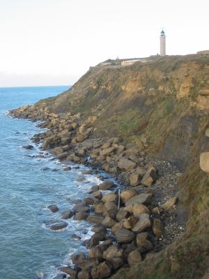
Cap Blanc-Nez rises 132 meters (433 feet) above sea level and marks the closest point to England, only 34 kilometers (21 miles) from the British coast. On clear days, the cliffs of Dover are visible to the naked eye.
The community of curious travelers
AroundUs brings together thousands of curated places, local tips, and hidden gems, enriched daily by 60,000 contributors worldwide.