Enable Location

We need your location to show you interesting places around you

Discover nearby places

Find interesting locations and hidden gems around you

Precise directions

Get accurate directions and distances to places

Your location is never shared with other users. It's only used when you tap the location button.

Pont de Sully

Log in to your account

Start exploring — it's free

Trusted by 62,064 travelers worldwide

Continue with Google
Continue with Apple
or

We will send you a code to connect

By continuing, you accept our Terms and Conditions and our Privacy Policy

Check your inbox

We've sent a pincode in your inbox. Please enter the code below.

Pont de Sully

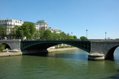
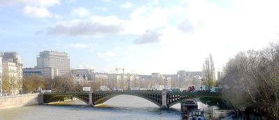
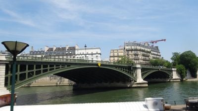
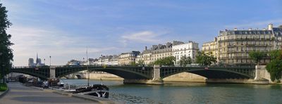
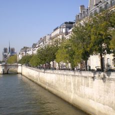
Pont de Sully, Road bridge in 4th arrondissement, France

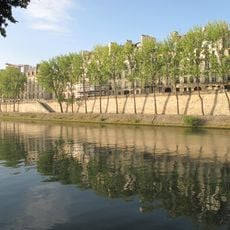
Pont de Sully is a road bridge spanning the Seine River in Paris, connecting the Right Bank with Île Saint-Louis and the Left Bank. The structure consists of two separate parts that meet at the eastern tip of the island.

Built in 1876, the bridge replaced two earlier pedestrian suspension bridges from the 19th century. Those older crossings were lost to damage and collapse, making way for a new, more durable passage across the Seine.

The bridge takes its name from Maximilien de Béthune, Duke of Sully, a powerful minister under King Henri IV. This naming choice keeps alive the memory of an important historical figure whose influence shaped France.

The Sully-Morland metro station on line 7 is the nearest public transit access, located on the Right Bank side. The bridge is straightforward to cross on foot and opens onto neighborhoods on both sides of the river.

The bridge has two distinctly different structural sections designed to meet the particular demands of its location. The southern half uses cast iron arches while the northern portion features a different engineering approach, creating an asymmetrical composition.

The community of curious travelers

AroundUs brings together thousands of curated places, local tips, and hidden gems, enriched daily by 60,000 contributors worldwide.

Start exploring
Location
Length
256 m
Part of
road network of Paris
Shares border with
boulevard Saint-Germain, quai de la Tournelle, boulevard Henri-IV, quai Saint-Bernard
GPS coordinates
48.85000,2.35917
Latest update
December 8, 2025 20:02
« Pont de Sully - Road bridge in 4th arrondissement, France » is provided by Around Us (aroundus.com). Images and texts are derived from Wikimedia project under a Creative Commons license. You are allowed to copy, distribute, and modify copies of this page, under the conditions set by the license, as long as this note is clearly visible.

Discover hidden gems everywhere you go!

From secret cafés to breathtaking viewpoints, skip the crowded tourist spots and find places that match your style. Our app makes it easy with voice search, smart filtering, route optimization, and insider tips from travelers worldwide. Download now for the complete mobile experience.

Around Us App Screenshot

A unique approach to discovering new places

Le Figaro

All the places worth exploring

France Info

A tailor-made excursion in just a few clicks

20 Minutes

Around Us
Travel Guide & Maps
Download

Send to your phone

QR Code
1

Open the camera app on your mobile.

2

Point at the QR code with your camera. A notification will appear.

3

Tap the notification to open the link.