Chest opened
+${chestReward.xp} XP
Explorer
NOUVEAU ×${chestReward.collectible.quantity}
tapez pour fermer
Chest locked

Open chests in the app

Around Us is built for your phone — chests unlock when you walk, explore and capture nearby places.

Enable Location

We need your location to show you interesting places around you

Discover nearby places

Find interesting locations and hidden gems around you

Precise directions

Get accurate directions and distances to places

Your location is never shared with other users. It's only used when you tap the location button.

Ligurische Grenzkammstraße

Log in to your account

Start exploring — it's free

Trusted by 72,995 travelers worldwide

Continue with Google
Continue with Apple
or

We will send you a code to connect

By continuing, you accept our Terms and Conditions and our Privacy Policy

Check your inbox

We've sent a pincode in your inbox. Please enter the code below.

Ligurische Grenzkammstraße
Discussion Reviews 1 Photos
20.7k Popularity

Ligurische Grenzkammstraße, Historic mountain road network in Maritime Alps, Italy and France.

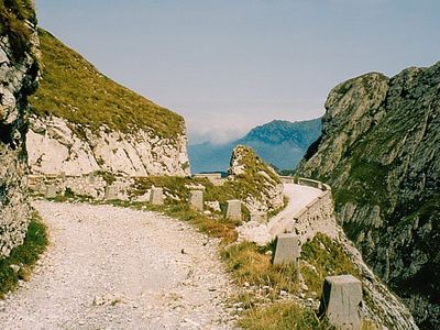
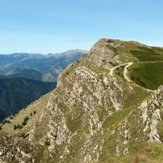
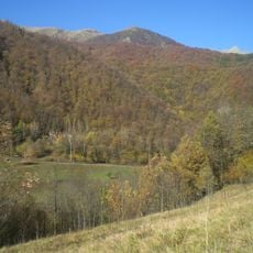
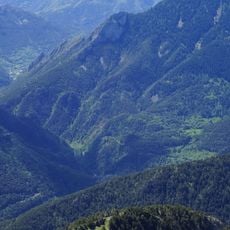
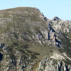
The Ligurische Grenzkammstraße is a mountain road stretching around 105 kilometers through the Maritime Alps, connecting Italy and France. The unpaved route winds across several passes at elevations between 1800 and 2100 meters, passing through rocky terrain and open alpine landscape.

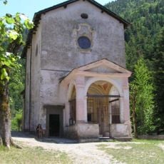
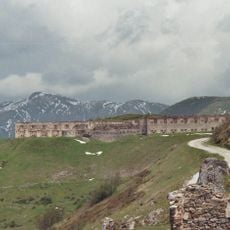
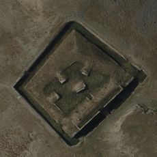
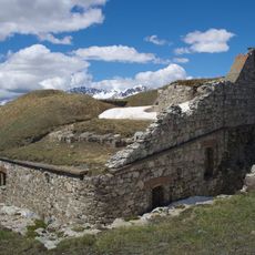
The road developed from ancient trade routes between the coast and mountain regions and was later expanded as a military path. From the 18th century through the 1940s, fortifications were built to secure and control the border between the two nations.

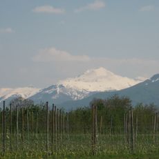
The road follows ancient trade routes that once connected coastal towns with mountain villages and shaped life in this region. Today, visitors can see how these historic paths still represent the connection between two nations and their ways of living.

The road is unpaved and requires a sturdy vehicle plus permits regulated at entry points. Driving is often restricted to certain times, and it is best to check current access conditions before traveling.

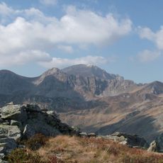
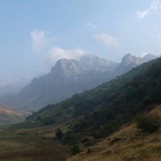
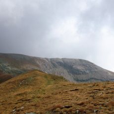
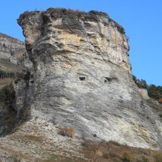
One section of the road passes through an area of jagged rock formations and sparse vegetation where the landscape appears particularly barren. This geologically distinctive zone offers visitors a chance to experience the raw side of the mountains in an unusually stark setting.

The community of curious travelers

AroundUs brings together thousands of curated places, local tips, and hidden gems, enriched daily by 60,000 contributors worldwide.

Start exploring
GPS coordinates
44.16123,7.66967
Latest update
December 7, 2025 10:05
Reviews
Share your experience

No review yet

Discussions
Start a discussion...

No discussion yet

« Ligurische Grenzkammstraße - Historic mountain road network in Maritime Alps, Italy and France » is provided by Around Us (aroundus.com). Images and texts are derived from Wikimedia project under a Creative Commons license. You are allowed to copy, distribute, and modify copies of this page, under the conditions set by the license, as long as this note is clearly visible.

Discover hidden gems everywhere you go!

From secret cafés to breathtaking viewpoints, skip the crowded tourist spots and find places that match your style. Our app makes it easy with voice search, smart filtering, route optimization, and insider tips from travelers worldwide. Download now for the complete mobile experience.

Around Us App Screenshot

A unique approach to discovering new places

Le Figaro

All the places worth exploring

France Info

A tailor-made excursion in just a few clicks

20 Minutes

Around Us
Travel Guide & Maps
Download

Send to your phone

QR Code
1

Open the camera app on your mobile.

2

Point at the QR code with your camera. A notification will appear.

3

Tap the notification to open the link.