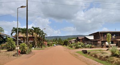
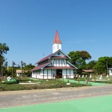
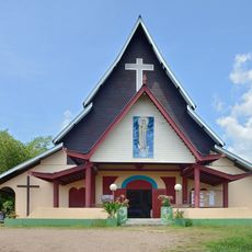
Cacao, French Guiana, Hmong village along Comté River in French Guiana.
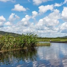
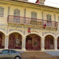
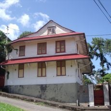
Cacao is a Hmong village along the Comté River in French Guiana organized into four residential blocks with narrow streets. The settlement sits within agricultural fields where residents grow traditional Asian and local crops.
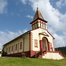
The French government established this community in 1977 by resettling Hmong refugees from Laos who sought similar environmental conditions to their homeland. The comparable climate and river landscape proved suitable for transplanting a population with deep agricultural roots in Southeast Asia.
The Sunday market draws sellers offering Hmong embroidery, traditional garments, regional produce, and Southeast Asian dishes that reflect the community's heritage. Daily life here revolves around agricultural practices and family traditions that remain visibly distinct from surrounding French settlements.
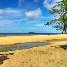
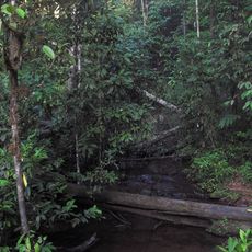
The village can be reached from Cayenne by car or via a two-hour motorized pirogue journey upriver from Roura. Water levels fluctuate seasonally, which affects river access and travel conditions throughout the year.
The community operates a freshwater prawn farm that exports over one ton of product monthly to markets in the United States and Puerto Rico. This specialized aquaculture enterprise sets it apart from typical economic activities found in other regional settlements.
GPS coordinates: 4.55349,-52.49216
Latest update: December 6, 2025 17:40
French Guiana is a region where tropical rainforests meet rivers and coastal areas. The landscape brings together South American nature with French history. You can visit nature reserves where birds and turtles live, explore colonial ruins, and see ancient rock carvings made by indigenous peoples....
Camp Crique Anguille
31 km
Fort Cépérou
46.1 km
Kaw-Roura Marshes National Nature Reserve
42.1 km
Habitation Loyola
45.7 km
Prefecture hotel of French Guiana
46.3 km
Museo departamental Alexandre-Franconie
46.3 km
Zoo de Guyane
43.7 km
Statue of Victor Schœlcher
46.1 km
Pont du Larivot
41.7 km
Fort Diamant
44.5 km
Place du Coq
46.1 km
Trésor Regional Nature Reserve
24.5 km
Église Saint-Jean-Baptiste de Montsinéry
37.7 km
Habitation Vidal
41.1 km
Réserve naturelle nationale du mont Grand Matoury
36.5 km
Maison Thémire
46.2 kmWindmill of Remire-Montjoly
44.5 km
Bibliothèque Franconie
46.3 km
Serpent de Pascaud
42.1 km
École Joséphine-Horth
46.2 km
Église Saint-Dominique de Roura
26.5 km
Plage de Gosselin
45.9 km
Ancienne douane
46 km
Église Saint-Louis de Tonnégrande
37.7 km
Maison Franconie
46.3 km
Église Hmong de Cacao
3.4 km
Sentier Molokoï
3.1 km
Maison, 6 rue du Fort
46.1 kmVisited this place? Tap the stars to rate it and share your experience / photos with the community! Try now! You can cancel it anytime.
Discover hidden gems everywhere you go!
From secret cafés to breathtaking viewpoints, skip the crowded tourist spots and find places that match your style. Our app makes it easy with voice search, smart filtering, route optimization, and insider tips from travelers worldwide. Download now for the complete mobile experience.
A unique approach to discovering new places❞
— Le Figaro
All the places worth exploring❞
— France Info
A tailor-made excursion in just a few clicks❞
— 20 Minutes