Enable Location

We need your location to show you interesting places around you

Discover nearby places

Find interesting locations and hidden gems around you

Precise directions

Get accurate directions and distances to places

Your location is never shared with other users. It's only used when you tap the location button.

Quai de Montebello

Log in to your account

Start exploring — it's free

Trusted by 62,067 travelers worldwide

Continue with Google
Continue with Apple
or

We will send you a code to connect

By continuing, you accept our Terms and Conditions and our Privacy Policy

Check your inbox

We've sent a pincode in your inbox. Please enter the code below.

Quai de Montebello

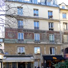
Quai de Montebello, Riverfront in 5th arrondissement, France

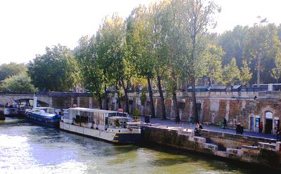
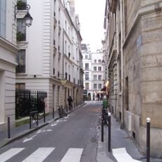
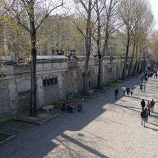
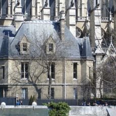
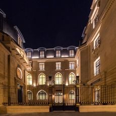
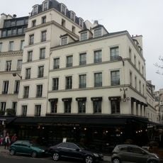
Quai de Montebello is a waterfront path along the Seine in Paris with direct views of Notre-Dame Cathedral. The roughly 300-meter-long and 15-meter-wide walkway connects different streets of the Latin Quarter and functions as a pedestrian zone facing the river.

This riverfront was established in 1811 as Quai Saint-Michel and renamed in 1843 to honor Jean Lannes, Duke of Montebello. The renaming reflected France's recognition of this Napoleonic-era military figure.

This riverbank path runs through the Latin Quarter, where students and thinkers have walked for centuries. People use it daily to move between universities and the Seine, creating an environment shaped by intellectual life.

The pedestrian path is about 15 meters wide and offers multiple access points between neighboring streets, making it easy to reach. The area connects to public transportation and is open to pedestrians throughout the day.

A German aircraft dropped a bomb near this location in 1918 during World War I, leaving a mark on Parisian wartime history. This moment connects the place to the larger conflicts that shaped the city during that period.

The community of curious travelers

AroundUs brings together thousands of curated places, local tips, and hidden gems, enriched daily by 60,000 contributors worldwide.

Start exploring
Length
314 m
Width
15 m
Part of
road network of Paris
Shares border with
place du Petit-Pont, quai de la Tournelle, quai Saint-Michel, rue de l'Hôtel-Colbert, rue du Haut-Pavé, rue Lagrange, rue Maître-Albert, rue Saint-Julien-le-Pauvre, Placette Jacques-Duhamel
GPS coordinates
48.85180,2.34937
Latest update
December 12, 2025 14:20
« Quai de Montebello - Riverfront in 5th arrondissement, France » is provided by Around Us (aroundus.com). Images and texts are derived from Wikimedia project under a Creative Commons license. You are allowed to copy, distribute, and modify copies of this page, under the conditions set by the license, as long as this note is clearly visible.

Discover hidden gems everywhere you go!

From secret cafés to breathtaking viewpoints, skip the crowded tourist spots and find places that match your style. Our app makes it easy with voice search, smart filtering, route optimization, and insider tips from travelers worldwide. Download now for the complete mobile experience.

Around Us App Screenshot

A unique approach to discovering new places

Le Figaro

All the places worth exploring

France Info

A tailor-made excursion in just a few clicks

20 Minutes

Around Us
Travel Guide & Maps
Download

Send to your phone

QR Code
1

Open the camera app on your mobile.

2

Point at the QR code with your camera. A notification will appear.

3

Tap the notification to open the link.