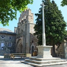
Mont d'Alambre, Volcanic mountain peak in Haute-Loire, France.
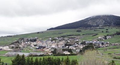
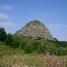
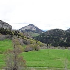
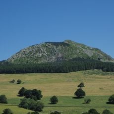
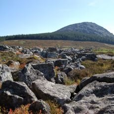
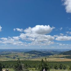
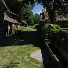
Mont d'Alambre is a volcanic peak rising to 1691 meters in the Massif Central of Haute-Loire. The mountain features rolling alpine meadows across its slopes and summit, creating a gentle landscape with expansive views toward distant plateaus and valleys.
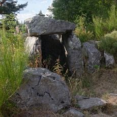
The mountain was recorded as Alambretum in the 11th century and documented as Mons Alambra by 1203 in regional records. This long presence in written history indicates the peak served as a recognized landmark for centuries in the local geography.
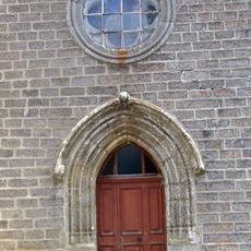
The mountain meadows remain a working pastoral landscape where shepherds graze their flocks following traditional practices passed down through generations. Visitors encounter this living heritage woven into the daily rhythm of the high plateau.
The hike to the summit departs from Les Estables on a 4.4 kilometer trail with about 300 meters of elevation gain. The ascent takes roughly 2 hours and is manageable for walkers with moderate fitness.
This peak operates both as a winter ski site with lifts reaching 1650 meters and as a summer paragliding launch point. This dual use makes the summit a gathering place for different kinds of mountain sports enthusiasts across the year.
Location: Haute-Loire
Elevation above the sea: 1,691 m
Website: http://geodesie.ign.fr/fiches/index.php?module=e&action=fichepdf&source=carte&sit_no=4309102
GPS coordinates: 44.91744,4.15364
Latest update: December 12, 2025 09:07
Mont Gerbier de Jonc
9.7 km
Viaduc de la Recoumène
10.8 km
Chartreuse de Bonnefoy
5.6 km
Suc de Sara
7.3 km
Château de Vachères
9.8 km
Lugik Parc
1.1 km
Suc de Montfol
8.1 km
Dolmen des Baumes
9.6 km
Suc de la Lauzière
7.1 km
Église Saint-Front de Saint-Front
6.7 km
Ferme Rudel
10.7 km
Croix de Saint-Front
6.7 km
Mont Mézenc
2.9 km
Église Saint-Nicolas de Freycenet-la-Tour
7.6 km
Église Saint-Pierre-aux-Liens
9.9 km
Le ventographe
4.9 km
Église Saint Pierre de Montusclat
10.9 km
Église Saint-Philibert des Estables
1.4 km
Église Saint-Clément de Saint-Clément
9.5 km
Ferme de Bigorre
9.7 km
Église Sainte-Anne des Vastres
11.7 km
Ferme Perrel
5.9 km
Église Saint-Jean-Baptiste de Freycenet-la-Cuche
5.8 km
Église Saint-Martial de Saint-Martial
11.1 km
Église Saint-Pierre du Béage
8.2 km
Chapelle de la chartreuse de Bonnefoy
5.5 km
Maison-forte de Freycenet
5.8 kmVisited this place? Tap the stars to rate it and share your experience / photos with the community! Try now! You can cancel it anytime.
Discover hidden gems everywhere you go!
From secret cafés to breathtaking viewpoints, skip the crowded tourist spots and find places that match your style. Our app makes it easy with voice search, smart filtering, route optimization, and insider tips from travelers worldwide. Download now for the complete mobile experience.
A unique approach to discovering new places❞
— Le Figaro
All the places worth exploring❞
— France Info
A tailor-made excursion in just a few clicks❞
— 20 Minutes