Montagne de Cotagne, Mountain summit in Les Clefs, France
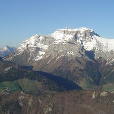
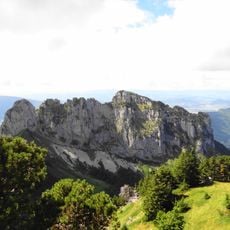
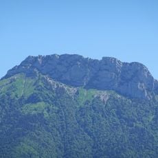
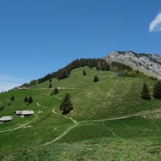
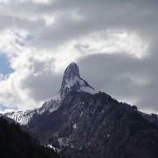
Montagne de Cotagne is a 1886-meter peak in the Bornes-Aravis massif with two distinct summits. The mountain displays a characteristic hogback structure with steep slopes descending on both sides.
Montagne de Cotagne takes its name from the Cotagne chalet on its northern flank, the destination of a hiking trail from Thônes. The mountain is a limestone hogback, the southern continuation of Mont Lachat beyond the Thônes cluse. To the south it connects to the Tournette via the Col des Frêtes de Rosairy at 1,752 metres.
The mountain takes its name from the Chalet de Cotagne on its northern flank, the destination of a hiking trail that starts in Thônes. The summit stands at 1,886 metres, with a secondary top to the north, the Rocher de Belchamp, at 1,860 metres. The col des Frêtes de Rosairy at 1,752 metres links the ridge southward to the Tournette.
The usual route starts from Thônes and follows the trail to the Chalet de Cotagne on the mountain's northern flank, the destination named in the peak's own name. From the col des Frêtes de Rosairy at 1752 metres, the mountain connects southward to the Tournette. The summit stands at 1886 metres, with the northern antecime, the Rocher de Belchamp, at 1860 metres.
The summit stands at 1,886 metres, with a lower northern shoulder called Rocher de Belchamp at 1,860 metres. The mountain takes its name from the Chalet de Cotagne on its northern flank, the destination of a hiking trail from Thônes.
The community of curious travelers
AroundUs brings together thousands of curated places, local tips, and hidden gems, enriched daily by 92,818 contributors worldwide.