Enable Location

We need your location to show you interesting places around you

Discover nearby places

Find interesting locations and hidden gems around you

Precise directions

Get accurate directions and distances to places

Your location is never shared with other users. It's only used when you tap the location button.

Log in to your account

Start exploring — it's free

Trusted by 63,045 travelers worldwide

Continue with Google
Continue with Apple
or

We will send you a code to connect

By continuing, you accept our Terms and Conditions and our Privacy Policy

Check your inbox

We've sent a pincode in your inbox. Please enter the code below.

Tête de Sanguinière
Discussion Reviews Photo
30+ Popularity

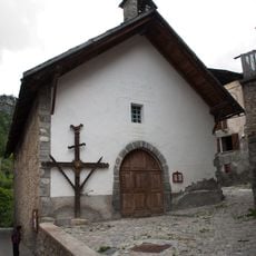
Tête de Sanguinière, Mountain summit in Alpes-de-Haute-Provence, France

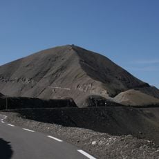
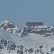
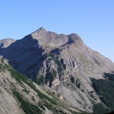
Tête de Sanguinière is a mountain summit in the Mercantour massif standing at 2,856 meters, with sparse forests and alpine grasslands spreading across its slopes. Walking paths cross through these varying landscapes, taking you from lower wooded areas to open high-altitude terrain.

The peak has served as a boundary marker between two administrative regions since medieval times and stands as a geographical reference point in the mountain landscape. Its position made it significant for distinguishing territorial areas across the high country.

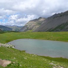
Herders still bring their flocks to the alpine meadows around this peak, and you can see how their grazing keeps the grasslands open and clear. This traditional practice shapes the landscape you walk through.

The trailhead is at Plateau de Sestrière car park, and the route is best tackled in dry conditions since exposed sections at higher elevations can become slippery. Sturdy hiking boots and weather-resistant clothing are essential since weather can change quickly in the mountains.

Ibex herds can be spotted gathering near this peak and the nearby Cime Plate during early morning and late afternoon hours. These wild mountain goats move across the high terrain during the quieter periods of the day.

The community of curious travelers

AroundUs brings together thousands of curated places, local tips, and hidden gems, enriched daily by 60,000 contributors worldwide.

Start exploring
Location
GPS coordinates
44.27000,6.79361
Latest update
December 15, 2025 13:24
Reviews
Share your experience

No review yet

Discussions
Start a discussion...

No discussion yet

« Tête de Sanguinière - Mountain summit in Alpes-de-Haute-Provence, France » is provided by Around Us (aroundus.com). Images and texts are derived from Wikimedia project under a Creative Commons license. You are allowed to copy, distribute, and modify copies of this page, under the conditions set by the license, as long as this note is clearly visible.

Discover hidden gems everywhere you go!

From secret cafés to breathtaking viewpoints, skip the crowded tourist spots and find places that match your style. Our app makes it easy with voice search, smart filtering, route optimization, and insider tips from travelers worldwide. Download now for the complete mobile experience.

Around Us App Screenshot

A unique approach to discovering new places

Le Figaro

All the places worth exploring

France Info

A tailor-made excursion in just a few clicks

20 Minutes

Around Us
Travel Guide & Maps
Download

Send to your phone

QR Code
1

Open the camera app on your mobile.

2

Point at the QR code with your camera. A notification will appear.

3

Tap the notification to open the link.