Fort Carra, Mountain summit in Alpes-Maritimes, France
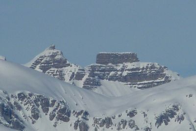
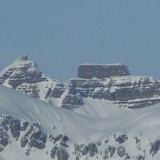
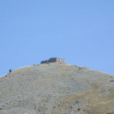
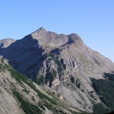
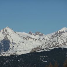
Fort Carra is a mountain summit in the Mercantour massif standing at about 2880 meters, known for its distinctive layered sedimentary rock formations that create fortress-like vertical walls. The peak sits in a rugged alpine environment with dramatic rock faces visible from many angles around the massif.
The peak received its name from early mountaineers who recognized the fortress-like shape of its rock columns in the 1800s. Routes to the summit developed gradually during the 1900s as French alpine climbing expanded and became more organized.
Local mountaineers gather annually at Fort Carra to maintain traditional climbing techniques and share knowledge about the mountain's various ascent possibilities.
The western face provides the most direct path, though climbing boots and ice gear are often needed due to weather conditions. Good footing on loose scree and rocky terrain is essential, so sturdy footwear and careful movement through exposed sections are important.
The layered rock faces display colors and patterns reminiscent of southwestern American canyon formations, creating a surprising visual link to distant mountain ranges. Few visitors realize that these sedimentary colorings actually reveal the geological history embedded directly in the cliff faces.
Location: Alpes-Maritimes
Elevation above the sea: 2,880 m
GPS coordinates: 44.24556,6.80750
Latest update: December 14, 2025 20:01
Cime de la Bonette
8.5 km
Pelat
8.4 km
Ouvrage Restefond
9.4 km
Ouvrage La Moutière
7.8 km
Cimet
9.6 km
Ouvrage Col de Restefond
10 km
Ouvrage Granges Communes
10.5 km
Saint-Étienne-de-Tinée - Chapelle Saint-Erige
10.2 km
Point d'appui de Pelousette
11.5 km
Saint-Étienne-de-Tinée - Ancien couvent des Trinitaires de Saint-Salaire
9.2 km
Côte de l'Âne
532 m
Église Saint-Dalmas de Saint-Dalmas-le-Selvage
6.3 km
Saint-Étienne-de-Tinée - Église des Dignitaires
9.5 km
Saint-Étienne-de-Tinée - Chapelle Saint-Sébastien
9.7 km
Batterie de la Tête de Vinaigre
9 km
Chapelle Sainte-Marguerite de Saint-Dalmas-le-Selvage
6.3 km
Roche Grande
4.2 km
Cime de Pal
4.7 km
Saint-Étienne-de-Tinée - Chapelle Saint-Maur
10.3 km
Chapelle Saint-Sébastien
7.8 km
Église Notre-Dame-de-la-Nativité
7.9 km
Chapelle Notre-Dame-des-Monts du lac d'Allos
8.1 km
Saint-Étienne-de-Tinée - Maison de Sébastien Fabri
9.4 km
Chapelle Saint-Guilhem de Saint-Martin-d'Entraunes
12 km
Chapelle Saint-Michel
9.6 km
Église Saint-Pierre de Bousiéyas
9.5 km
Chapelle Notre-Dame-du-Rosaire d'Entraunes
7.9 km
Saint-Étienne-de-Tinée - Oratoire du Pilon
10.4 kmVisited this place? Tap the stars to rate it and share your experience / photos with the community! Try now! You can cancel it anytime.
Discover hidden gems everywhere you go!
From secret cafés to breathtaking viewpoints, skip the crowded tourist spots and find places that match your style. Our app makes it easy with voice search, smart filtering, route optimization, and insider tips from travelers worldwide. Download now for the complete mobile experience.
A unique approach to discovering new places❞
— Le Figaro
All the places worth exploring❞
— France Info
A tailor-made excursion in just a few clicks❞
— 20 Minutes