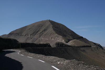
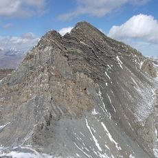
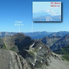
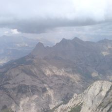
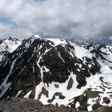
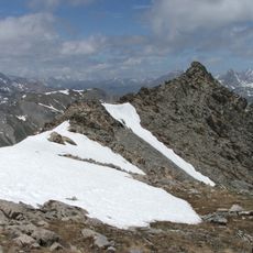
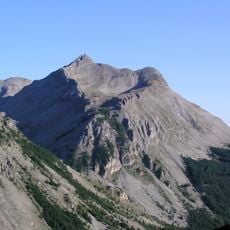
Cime de la Bonette, Mountain summit in Alpes-Maritimes, France
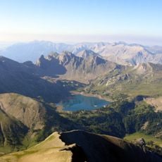
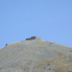
Cime de la Bonette is a mountain peak in the Mercantour National Park located in the Alpes-Maritimes region. A scenic road winds around the summit, creating an unusual loop that climbs to its upper reaches.
The road around this peak became part of the Tour de France route beginning in 1962. Since then the mountain has played an important role in professional cycling history as the site of memorable athletic moments.
The mountain pass serves as a natural border between the departments of Alpes-Maritimes and Alpes-de-Haute-Provence, reflecting regional administrative divisions.
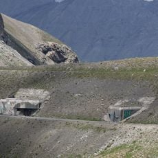
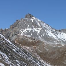
Access to the peak is possible both by hiking and cycling, with the route presenting different difficulty levels depending on your starting point. Weather conditions can change rapidly at this elevation, so it is wise to pack appropriate gear and be prepared for sudden shifts.
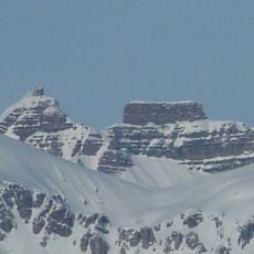
The loop around the summit reaches above 2,800 meters and stands as Europe's highest continuously paved through route. This engineering achievement connects two valleys at an altitude that few other continental roads attain.
Location: Alpes-Maritimes
Elevation above the sea: 2,860 m
GPS coordinates: 44.32162,6.80689
Latest update: December 10, 2025 15:57
Pelat
10.2 km
Château des Magnans
11.9 km
Ouvrage Restefond
977 m
Ouvrage La Moutière
1.2 km
Enciastraia
8.2 km
Cimet
8.9 km
Ouvrage Col de Restefond
1.5 km
Le Chapeau du Gendarme
11.4 km
Ouvrage Granges Communes
2.6 km
Rocca dei Tre Vescovi
7.8 km
Fort Carra
8.5 km
Point d'appui de Pelousette
4.6 km
Saint-Étienne-de-Tinée - Ancien couvent des Trinitaires de Saint-Salaire
11.6 km
Côte de l'Âne
8.5 km
Église Saint-Dalmas de Saint-Dalmas-le-Selvage
6.4 km
Saint-Étienne-de-Tinée - Église des Dignitaires
12 km
Saint-Étienne-de-Tinée - Chapelle Saint-Sébastien
12.3 km
Mont Bal
9.6 km
Église Saint-Nicolas-de-Myre de Jausiers
12.4 km
Cima delle Lose
10.9 km
Batterie de la Tête de Vinaigre
6.1 km
Chapelle Sainte-Marguerite de Saint-Dalmas-le-Selvage
6.2 km
Roche Grande
12.1 km
Église Saint-Laurent de Fours
9.1 km
Chapelle Notre-Dame-des-Monts du lac d'Allos
12.3 km
Saint-Étienne-de-Tinée - Maison de Sébastien Fabri
11.9 km
Église Saint-Pierre de Bousiéyas
4.3 km
Chapelle Saint-Michel
12.1 kmVisited this place? Tap the stars to rate it and share your experience / photos with the community! Try now! You can cancel it anytime.
Discover hidden gems everywhere you go!
From secret cafés to breathtaking viewpoints, skip the crowded tourist spots and find places that match your style. Our app makes it easy with voice search, smart filtering, route optimization, and insider tips from travelers worldwide. Download now for the complete mobile experience.
A unique approach to discovering new places❞
— Le Figaro
All the places worth exploring❞
— France Info
A tailor-made excursion in just a few clicks❞
— 20 Minutes