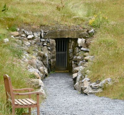
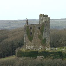
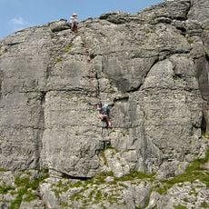
Pol an Ionain, Show cave in County Clare, Ireland
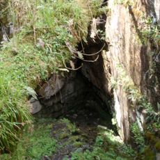
Poll an Ionain is a limestone cave system beneath County Clare that extends approximately 600 meters underground. The system features intricately shaped stalactites and stalagmites formed through water erosion over millions of years.
The cave was discovered in 1952 when British cavers found a passage leading to the underground network beneath the surface. This discovery eventually opened the site to visitors and revealed the geological processes that shaped the karst landscape.
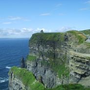
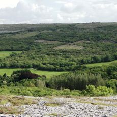
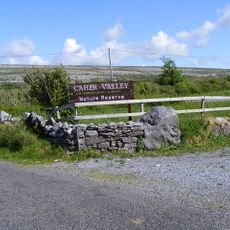
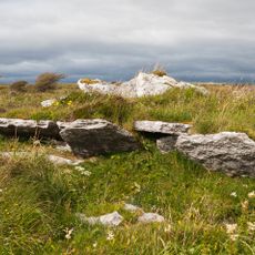
The Irish name Poll an Ionain refers to the ivy-covered cliffs above the cave, which shape how this landscape appears to visitors today. The surrounding features remain central to understanding what the name describes in the Burren environment.
The cave maintains a constant temperature around 11°C year-round, so warm and weather-appropriate clothing is necessary for comfort. Visitors should wear sturdy shoes with good grip to move safely on wet and uneven surfaces during the tour.
A notably large free-hanging stalactite descends from the ceiling and stands out because of its exceptional length. This rock formation ranks among the longest of its kind in the region and demonstrates the impressive power of natural formation processes.
Location: Doolin
Website: http://doolincave.ie
GPS coordinates: 53.04194,-9.34500
Latest update: December 6, 2025 16:04
Ireland offers photographers a combination of historical structures, landscape formations and coastal sections. The island contains medieval fortresses such as Blarney Castle and Rock of Cashel, basalt formations at Giant's Causeway, and early medieval monastery sites at Glendalough. Trinity College Library in Dublin displays historical architecture, while Kilmainham Gaol provides insights into 19th and 20th century Irish history. Natural formations include the Cliffs of Moher in County Clare, rising 702 feet (214 meters) above the Atlantic, and the prehistoric burial mound at Newgrange in County Meath. The Dark Hedges in County Antrim form a tunnel of 18th century beech trees. National parks such as Killarney, Connemara and Glenveagh show different landscape types from lake districts to moorland. Coastal sections along the Ring of Kerry and Dingle Peninsula, plus smaller locations like Hook Head Lighthouse and Cobh, complete the island's geographic range.
O'Brien's Tower
9.6 km
Doonagore Castle
5.1 km
Ballinalacken Castle
698 m
O'Brien's Castle
11.9 km
Pollnagollum
7.4 km
Gregans Castle
11.4 km
St Brigid's Well
11.3 km
Dough Castle
10.1 km
Kilfenora Cathedral and Crosses
10.3 km
Ennistymon House
11.6 km
Kilmacrehy
10 km
Ballyryan
2.9 km
Spectacle Bridge
3.2 km
Caher Valley
10.4 km
Faunarooska, Rathborney, Wedge Tomb Cl. 4
10 km
Dun Formna
11.9 km
Ballyteigue
5.6 km
Cahermacnaughten
9.8 km
Kirche von Kilmacreehy
11.1 km
Carn Connachtach
8.2 km
Caomhan's Church
11.6 km
Noughaval Market Stone
11.4 km
New Bridge
9.7 km
St Mochua's Church
11.3 km
Corpus Christi Church
3.9 km
O'Brien's Bridge
10.6 km
St Fachanan's Church
10.2 km
Noughaval Early Monastic Site
11.4 kmVisited this place? Tap the stars to rate it and share your experience / photos with the community! Try now! You can cancel it anytime.
Discover hidden gems everywhere you go!
From secret cafés to breathtaking viewpoints, skip the crowded tourist spots and find places that match your style. Our app makes it easy with voice search, smart filtering, route optimization, and insider tips from travelers worldwide. Download now for the complete mobile experience.
A unique approach to discovering new places❞
— Le Figaro
All the places worth exploring❞
— France Info
A tailor-made excursion in just a few clicks❞
— 20 Minutes