Aurangabad district, Administrative district in Magadh division, Bihar, India.
Aurangabad district is an administrative region in the Magadh area of Bihar that is divided into several subdivisions, including Aurangabad Sadar and Daudnagar. These subdivisions contain towns and villages spread across a varied landscape that serves as both an agricultural and administrative hub.
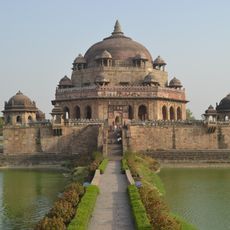
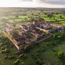
The area was part of the ancient Magadh kingdom, which was central to the rise of Buddhism and early Indian civilization. This heritage shaped the region's importance across many centuries.
People here speak several languages daily, switching between Hindi, Urdu, and local dialects in conversation. The streets come alive during festivals, when neighborhoods fill with celebrations that reflect the area's diverse communities.
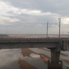
The city of Aurangabad serves as the main administrative center where you will find government offices and services. Before visiting, check local transport options and consider the weather conditions, as the region experiences strong seasonal changes.
The district's economy relies heavily on farming, which has supported local communities for generations and shaped daily life. Yet it also hosts several educational institutions that draw students from across the region seeking opportunities.
The community of curious travelers
AroundUs brings together thousands of curated places, local tips, and hidden gems, enriched daily by 60,000 contributors worldwide.