Enable Location

We need your location to show you interesting places around you

Discover nearby places

Find interesting locations and hidden gems around you

Precise directions

Get accurate directions and distances to places

Your location is never shared with other users. It's only used when you tap the location button.

Log in to your account

Start exploring — it's free

Trusted by 61,575 travelers worldwide

Continue with Google
Continue with Apple
or

We will send you a code to connect

By continuing, you accept our Terms and Conditions and our Privacy Policy

Check your inbox

We've sent a pincode in your inbox. Please enter the code below.

Baran district

Baran district, Administrative district in Rajasthan, India

Description

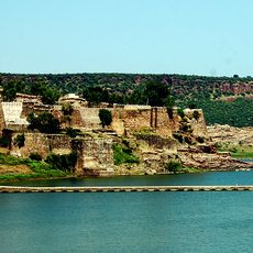
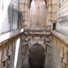
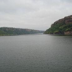
Baran district is an administrative region in Rajasthan with varied terrain shaped by three major rivers—the Kalisindh, Parvati, and Parban—that flow through its boundaries. The area sits at approximately 262 meters elevation and features diverse landscape types.

History

The district was separated from neighboring Kota in 1991 and established as an independent administrative division. This administrative reorganization marks a turning point in the region's recent development.

Culture

The Hadoti language shapes daily communication and connects locals through a shared linguistic heritage that has endured for generations. You'll hear it spoken throughout markets, villages, and streets, where it remains central to the region's identity.

Practical

National Highway 76 links the region to neighboring areas and makes it easy to reach. The railway station on the Kota-Bina line offers train connections to major cities.

Did you know?

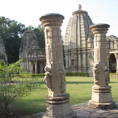
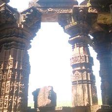
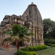
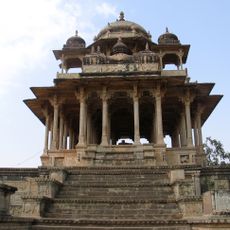
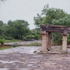
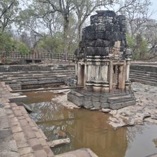
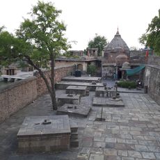
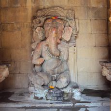
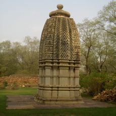
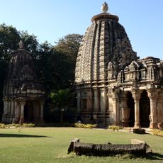
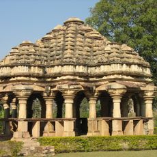
A 10th-century temple built in Khajuraho architectural style stands near a meteorite impact crater, roughly 40 kilometers from the city. This rare combination of cultural landmark and cosmic event makes the location particularly notable for visitors.

Location
Inception
April 10, 1991
Capital city
Baran
Elevation above the sea
262 m
Shares border with
Kota district, Guna district
GPS coordinates
25.10000,76.51000
Latest update
December 7, 2025 19:26

AroundUs brings together thousands of curated places, local tips, and hidden gems, enriched daily by 60,000 contributors worldwide. Discover all places nearby (Kota division).

« Baran district - Administrative district in Rajasthan, India » is provided by Around Us (aroundus.com). Images and texts are derived from Wikimedia project under a Creative Commons license. You are allowed to copy, distribute, and modify copies of this page, under the conditions set by the license, as long as this note is clearly visible.

Discover hidden gems everywhere you go!

From secret cafés to breathtaking viewpoints, skip the crowded tourist spots and find places that match your style. Our app makes it easy with voice search, smart filtering, route optimization, and insider tips from travelers worldwide. Download now for the complete mobile experience.

Around Us App Screenshot

A unique approach to discovering new places

Le Figaro

All the places worth exploring

France Info

A tailor-made excursion in just a few clicks

20 Minutes

Around Us
Travel Guide & Maps
Download

Send to your phone

QR Code
1

Open the camera app on your mobile.

2

Point at the QR code with your camera. A notification will appear.

3

Tap the notification to open the link.