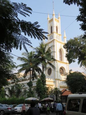
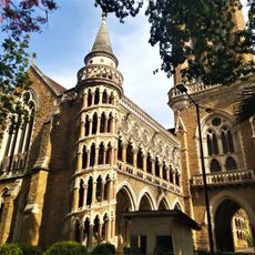
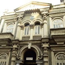
St. Thomas Cathedral, Mumbai, Anglican cathedral in Horniman Circle, Mumbai, India
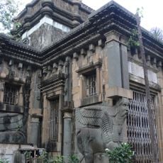
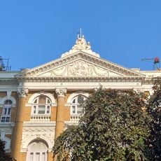
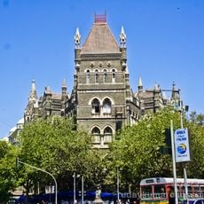
The stone cathedral displays Tuscan columns, vaulted ceilings, and numerous carved memorial tablets from the British colonial era throughout its interior chambers. The three-aisled design shows classical Georgian architectural elements with symmetrical facades and rectangular windows. A square tower rises above the western entrance, housing bells that ring for services. Wooden pews fill the nave beneath the vaulted ceiling.
Foundation work began in 1676, though construction stalled until 1715, with final completion and consecration taking place on Christmas Day 1718. Governor Gerald Aungier authorized the original project as part of the East India Company's expansion in Bombay. Throughout the 18th century, the structure served British merchants and military personnel as the primary place of worship. Renovations during the 19th century added more memorial tablets and reinforced structural integrity against monsoon rains.
The structure serves as the principal cathedral of the Anglican Diocese of Mumbai within the Church of North India, maintaining regular worship since its establishment. The building represents the enduring presence of Anglican traditions in a predominantly Hindu and Muslim city. Numerous stone memorial tablets commemorate British colonial officials, military officers, and civilians who died in India. The congregation today maintains connections with modern Christian communities across Mumbai.
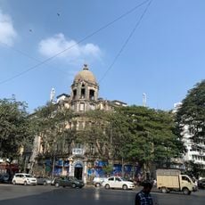
The cathedral holds Holy Communion services every Sunday at 8:40 AM and sits near Churchgate railway station, Flora Fountain, and Bombay House. Visitors may enter during service times or stop by weekdays between 9:00 AM and 5:00 PM. Conservative attire is recommended for attending church functions. Horniman Circle Garden across the street provides a quiet resting spot after exploration. Photography inside is typically permitted without flash.
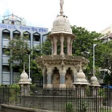
The cathedral marks Mumbai's point zero, from which 16 milestone markers were positioned northward to measure distances across the expanding city. This surveying system established the church as the geographic center for colonial urban planning and infrastructure development. The original stone milestones still stand at various locations along major roadways. Cartographers used this reference point to create official maps of British Bombay during the 18th and 19th centuries.
The community of curious travelers
AroundUs brings together thousands of curated places, local tips, and hidden gems, enriched daily by 60,000 contributors worldwide.