Enable Location

We need your location to show you interesting places around you

Discover nearby places

Find interesting locations and hidden gems around you

Precise directions

Get accurate directions and distances to places

Your location is never shared with other users. It's only used when you tap the location button.

Log in to your account

Start exploring — it's free

Trusted by 61,909 travelers worldwide

Continue with Google
Continue with Apple
or

We will send you a code to connect

By continuing, you accept our Terms and Conditions and our Privacy Policy

Check your inbox

We've sent a pincode in your inbox. Please enter the code below.

Naxalbari community development block

Naxalbari community development block, Administrative block in Siliguri subdivision, India

Naxalbari is an administrative block located in the Siliguri subdivision at the foothills of the Himalayas in West Bengal. The block spans around 182 square kilometers and includes several rural settlements with villages and smaller hamlets spread across the region.

The region gained national attention in 1967 when farmers began an uprising to demand land rights, sparking an important social movement. This event became a turning point that reshaped local politics and society in the following decades.

The people here speak Bengali as their main language, with Nepali and Sadri also heard regularly in daily life. This mix of languages reflects the different communities that have made this region their home.

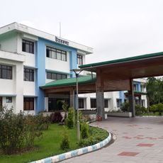
The block has a hospital and several medical facilities to serve the rural population. Electricity reaches all villages, and there are various schools located throughout the communities.

The region is divided into six Gram Panchayats extending from north to south, serving as local governance units for the different villages. This decentralized structure allows local leaders to stay closely connected with their communities.

The community of curious travelers

AroundUs brings together thousands of curated places, local tips, and hidden gems, enriched daily by 60,000 contributors worldwide.

Start exploring
Capital city
Naksalbari
Shares border with
Mirik community development block, Kurseong community development block, Matigara community development block, Phansidewa community development block, Kharibari community development block
GPS coordinates
26.68000,88.22000
Latest update
December 12, 2025 09:02
« Naxalbari community development block - Administrative block in Siliguri subdivision, India » is provided by Around Us (aroundus.com). Images and texts are derived from Wikimedia project under a Creative Commons license. You are allowed to copy, distribute, and modify copies of this page, under the conditions set by the license, as long as this note is clearly visible.

Discover hidden gems everywhere you go!

From secret cafés to breathtaking viewpoints, skip the crowded tourist spots and find places that match your style. Our app makes it easy with voice search, smart filtering, route optimization, and insider tips from travelers worldwide. Download now for the complete mobile experience.

Around Us App Screenshot

A unique approach to discovering new places

Le Figaro

All the places worth exploring

France Info

A tailor-made excursion in just a few clicks

20 Minutes

Around Us
Travel Guide & Maps
Download

Send to your phone

QR Code
1

Open the camera app on your mobile.

2

Point at the QR code with your camera. A notification will appear.

3

Tap the notification to open the link.