Enable Location

We need your location to show you interesting places around you

Discover nearby places

Find interesting locations and hidden gems around you

Precise directions

Get accurate directions and distances to places

Your location is never shared with other users. It's only used when you tap the location button.

Log in to your account

Start exploring — it's free

Trusted by 62,472 travelers worldwide

Continue with Google
Continue with Apple
or

We will send you a code to connect

By continuing, you accept our Terms and Conditions and our Privacy Policy

Check your inbox

We've sent a pincode in your inbox. Please enter the code below.

Gauri Parbat

Gauri Parbat, Mountain summit in Joshimath Tehsil, India.

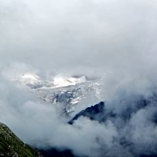
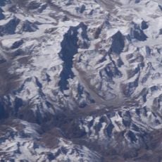
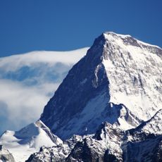
Gauri Parbat is a mountain summit in the Garhwal Himalayan range that rises to 6,708 meters (22,000 feet) and features steep rock walls, glacial formations, and exposed ridges. The slopes are composed of fractured rock and ice, with the terrain becoming progressively more technical at higher elevations.

The first successful summit was reached in 1939 when a mountaineering team completed their ascent and marked an important moment in the region's climbing history. This early achievement brought attention to the mountain and helped establish its reputation as an accessible objective for high-altitude mountaineers.

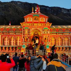
Local communities view this peak as a sacred place within Hindu traditions, and this reverence shapes how people in nearby villages connect with the mountain. The spiritual significance remains visible in local customs and the way inhabitants relate to the landscape.

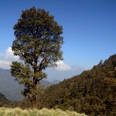
Access to the mountain is typically organized from Joshimath, where climbers begin their expeditions and undergo acclimatization. Visitors should be prepared for high altitude conditions and unpredictable weather, which demand careful planning and suitable gear for mountaineering.

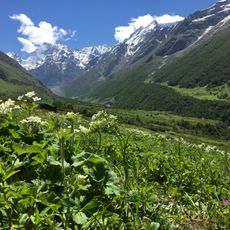
The peak sits near the Valley of Flowers, a region famous for its rare alpine plant life, offering climbers an unexpected contrast between harsh high-altitude terrain and colorful vegetation. This proximity allows visitors to experience two dramatically different landscapes during the same expedition.

The community of curious travelers

AroundUs brings together thousands of curated places, local tips, and hidden gems, enriched daily by 60,000 contributors worldwide.

Start exploring
Location
Joshimath Tehsil
Elevation above the sea
6,708 m
GPS coordinates
30.71106,79.69932
Latest update
December 14, 2025 18:20
« Gauri Parbat - Mountain summit in Joshimath Tehsil, India » is provided by Around Us (aroundus.com). Images and texts are derived from Wikimedia project under a Creative Commons license. You are allowed to copy, distribute, and modify copies of this page, under the conditions set by the license, as long as this note is clearly visible.

Discover hidden gems everywhere you go!

From secret cafés to breathtaking viewpoints, skip the crowded tourist spots and find places that match your style. Our app makes it easy with voice search, smart filtering, route optimization, and insider tips from travelers worldwide. Download now for the complete mobile experience.

Around Us App Screenshot

A unique approach to discovering new places

Le Figaro

All the places worth exploring

France Info

A tailor-made excursion in just a few clicks

20 Minutes

Around Us
Travel Guide & Maps
Download

Send to your phone

QR Code
1

Open the camera app on your mobile.

2

Point at the QR code with your camera. A notification will appear.

3

Tap the notification to open the link.