Enable Location

We need your location to show you interesting places around you

Discover nearby places

Find interesting locations and hidden gems around you

Precise directions

Get accurate directions and distances to places

Your location is never shared with other users. It's only used when you tap the location button.

Brennisteinsfjöll

Log in to your account

Start exploring — it's free

Trusted by 62,848 travelers worldwide

Continue with Google
Continue with Apple
or

We will send you a code to connect

By continuing, you accept our Terms and Conditions and our Privacy Policy

Check your inbox

We've sent a pincode in your inbox. Please enter the code below.

Brennisteinsfjöll

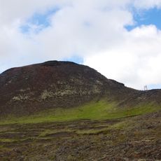
Brennisteinsfjöll, Volcanic mountain system in Grindavíkurbær, Iceland

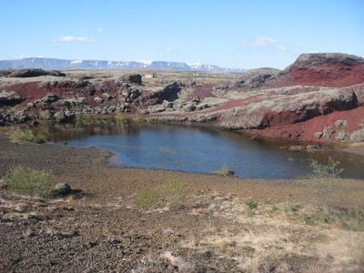
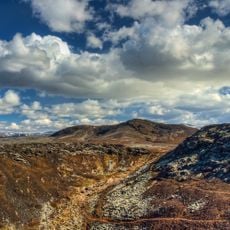
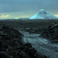
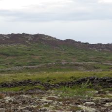
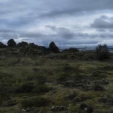
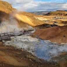
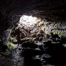
Brennisteinsfjöll is a volcanic mountain system on the Reykjanes Peninsula with multiple crater rows and active geothermal features. The landscape reveals the form of a shield volcano with visible fissures, cone formations, and steam vents that indicate ongoing thermal activity below the surface.

The mountain system formed during multiple eruption cycles in the Holocene period, with the most recent major event in 1341. That eruption had far-reaching effects on European climate patterns, demonstrating the global reach of Icelandic volcanic activity.

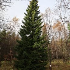
The name translates to 'sulfur mountain' in Icelandic, referring to the yellow sulfur deposits that color the landscape. Visitors notice how the geothermal features shape the way locals and travelers think about this raw, active part of the island.

Marked trails guide visitors through the area and staying on established paths protects the delicate geothermal environment. Sturdy footwear matters because hot springs and steam vents can appear without warning along the route.

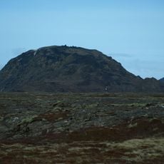
The Stóra-Kóngsfell and Þríhnúkagígar craters are exceptionally well-preserved formations that reveal patterns about underground magmatic movement. Visitors who examine these craters closely can see evidence of how magma fed earlier eruptions and shaped the final crater patterns.

The community of curious travelers

AroundUs brings together thousands of curated places, local tips, and hidden gems, enriched daily by 60,000 contributors worldwide.

Start exploring
Location
Elevation above the sea
621 m
Part of
Geology of Reykjanes Peninsula
GPS coordinates
63.91667,-21.83333
Latest update
December 13, 2025 11:48
« Brennisteinsfjöll - Volcanic mountain system in Grindavíkurbær, Iceland » is provided by Around Us (aroundus.com). Images and texts are derived from Wikimedia project under a Creative Commons license. You are allowed to copy, distribute, and modify copies of this page, under the conditions set by the license, as long as this note is clearly visible.

Discover hidden gems everywhere you go!

From secret cafés to breathtaking viewpoints, skip the crowded tourist spots and find places that match your style. Our app makes it easy with voice search, smart filtering, route optimization, and insider tips from travelers worldwide. Download now for the complete mobile experience.

Around Us App Screenshot

A unique approach to discovering new places

Le Figaro

All the places worth exploring

France Info

A tailor-made excursion in just a few clicks

20 Minutes

Around Us
Travel Guide & Maps
Download

Send to your phone

QR Code
1

Open the camera app on your mobile.

2

Point at the QR code with your camera. A notification will appear.

3

Tap the notification to open the link.