Appian Way, Ancient road in Rome, Italy
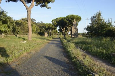
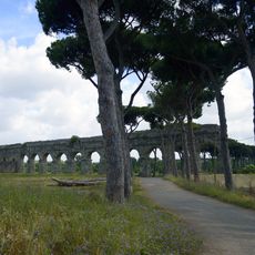
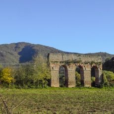
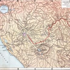
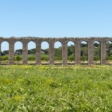
The Appian Way runs 430 miles from Rome to Brindisi along a path of large basalt blocks fitted closely without mortar. The roadbed crosses farmland past ruins of villas, aqueducts, and milestones that once told travelers how far they stood from the city center.
Appius Claudius Caecus ordered construction to begin in 312 BC as a military corridor to move troops south during wars with the Samnites. Later extensions pushed the route farther toward Brindisi, linking Rome to ports that opened trade and passage east across the Mediterranean.
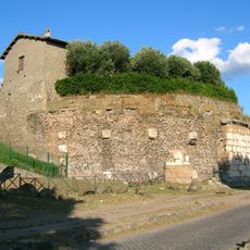
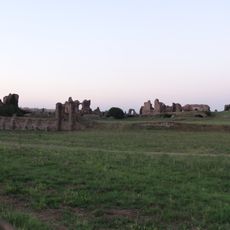
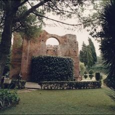
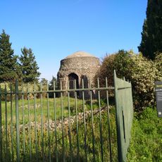
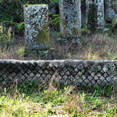
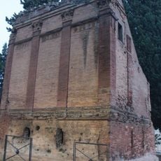
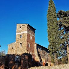
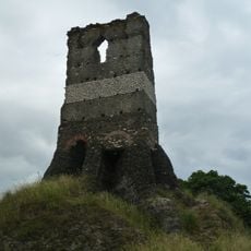
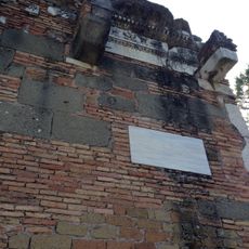
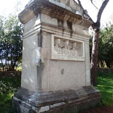
Stone-carved tombs line both sides of the ancient roadbed, built by families who wanted their dead remembered by everyone traveling past. Two major catacombs beneath the surface hold thousands of early Christian burials arranged in corridors that extend for miles underground.
Metro or bus lines from central Rome drop visitors near the starting gate at Porta San Sebastiano, where bike rental shops offer an easier way to cover long distances. The first few kilometers hold the best-preserved pavement and monuments, while farther sections become rougher and less accessible on foot.
A 62-kilometer stretch near Terracina runs perfectly straight without any turn, making it the longest such segment in Europe. Roman surveyors managed this alignment by sighting across distant peaks and draining marshland to keep the roadbed level and direct.
Location: Rome
Location: Brindisi
Inception: 312 BCE
Founders: Appius Claudius Caecus
Part of: Via Appia. Regina Viarum
Website: https://camminodellappia.it
GPS coordinates: 41.84139,12.53250
Latest update: December 12, 2025 16:51
Rome preserves more than 2,000 years of architectural history within its city limits, maintaining ancient temples and amphitheaters beside Renaissance churches and Baroque piazzas. The Roman Forum displays ruins from the first century BC through the fourth century AD, including government buildings...
Parco degli Acquedotti
2.5 km
Aqua Marcia
2.6 km
Villa of the Quintilii
2 km
Anio Novus
2.4 km
Tomb of Hilarus Fuscus
492 m
Casal Rotondo
3 km
Church of St. Policarp
2.4 km
Acqua Santa Golf Club Course
1.4 km
Villa of the Sette Bassi
3.6 km
Santa Maria Annunziata fuori le mura
1.9 km
Antiquarium Lucrezia Romana
3.9 km
Villa dei Quintili
4.1 km
Sant'Ignazio d'Antiochia
2 km
Ex sede dell'Istituto Nazionale Luce
3.4 km
St. Urban’s Mausoleum
318 m
Berretta del prete
6.5 km
Emporion
5.9 km
Pyramid of via Appia
1.8 km
Via Bisignano Sepulchre
2.3 km
Santa Maria Nova
1.7 km
Torre Selce
3.6 km
Tomb of Marcus Servilius Quartus
36 m
Santa Giovanna Antida Thouret (Rome - Fonte Meravigliosa)
2.7 km
Fountain
2.5 km
Tomb of Rabirii (Rome)
793 m
Fountain
2.3 km
Fountain
3.8 km
Fountain
3.7 kmVisited this place? Tap the stars to rate it and share your experience / photos with the community! Try now! You can cancel it anytime.
Discover hidden gems everywhere you go!
From secret cafés to breathtaking viewpoints, skip the crowded tourist spots and find places that match your style. Our app makes it easy with voice search, smart filtering, route optimization, and insider tips from travelers worldwide. Download now for the complete mobile experience.
A unique approach to discovering new places❞
— Le Figaro
All the places worth exploring❞
— France Info
A tailor-made excursion in just a few clicks❞
— 20 Minutes