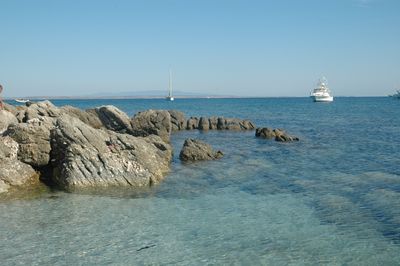
Mal di Ventre, Mediterranean island in Province of Oristano, Italy
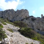
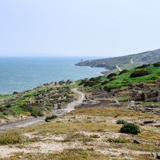
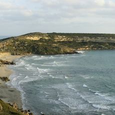
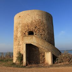
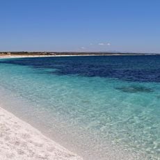
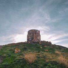
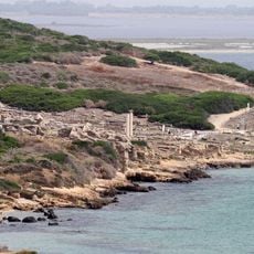
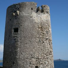
Mal di Ventre is a granite island off the Sardinian coast that stretches roughly 2 kilometers in length and rises to about 18 meters above sea level. The rocky terrain supports little vegetation but displays several ancient structures from Roman times across its surface.
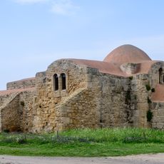
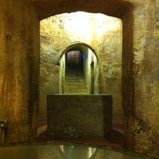
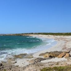
The island was inhabited in ancient times, as Roman wells and other remains still visible today demonstrate. These structures suggest the Romans valued the site for water collection and storage purposes.
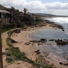
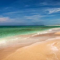
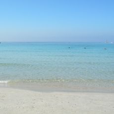
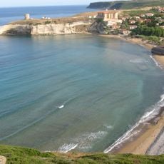
The island's name comes from Sardinian words referring to the strong winds that sweep across these waters. You can feel how the wind shapes the landscape and the daily conditions when you visit.
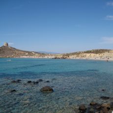
The island is only accessible by boat, with departures from the ports of Cabras and Putzu Idu during the sailing season. Visitors should prepare for exposure to sun and wind, as shelter on the island is minimal.
A local activist attempted to establish an independent republic on the uninhabited island in 2008 by setting up residence in a blue tent. This unusual episode shows how the remote islet occasionally becomes the stage for unexpected events.
Location: Province of Oristano
Elevation above the sea: 18 m
GPS coordinates: 39.99000,8.30917
Latest update: December 6, 2025 16:03
Sardinia preserves traces of human settlement across thousands of years. The island presents prehistoric cult sites including sacred wells and burial mounds that show ancient rituals. Nuraghe towers from the Bronze Age still rise above the landscape, while Roman theaters and Punic temples mark later...
Giants of Mont'e Prama
12.2 km
Tharros
17.2 km
Is Arutas beach
9 km
Capo San Marco
18.2 km
San Giovanni di Sinis
16.3 km
Area marina protetta Penisola del Sinis - Isola Mal di Ventre
13.3 km
Museo Civico Giovanni Marongiu
19.8 km
San Salvatore
14.4 km
Capo San Marco Lighthouse
18 km
Torre Grande Lighthouse
20 km
Maria Assunta
19.7 km
Golf Club Is Arenas
16.4 km
Tower of Su Pottu
18.9 km
Tower of Capo San Marco
17.8 km
Santa Maria Stella Maris
20 km
Spiaggia di Sa Capanna
18.6 km
Saint Martin church
19.7 km
Spiaggia di Maimoni
11.7 km
Santo Spirito
20 km
Spiaggia di Mari Ermi
8 km
Spiaggia Is Arutas
9 km
Spiaggia Putzu Idu
9.4 km
Torre di San Giovanni
17.1 km
Tharros amphitheatre
16.9 km
Beach of San Giovanni di Sinis
16.3 km
Torre di Seu
13 km
Spiaggia di Santa Caterina
20 km
Ponds in the Bay of Oristano and the Sinis Peninsula island of Mal di Ventre
11.2 kmVisited this place? Tap the stars to rate it and share your experience / photos with the community! Try now! You can cancel it anytime.
Discover hidden gems everywhere you go!
From secret cafés to breathtaking viewpoints, skip the crowded tourist spots and find places that match your style. Our app makes it easy with voice search, smart filtering, route optimization, and insider tips from travelers worldwide. Download now for the complete mobile experience.
A unique approach to discovering new places❞
— Le Figaro
All the places worth exploring❞
— France Info
A tailor-made excursion in just a few clicks❞
— 20 Minutes