Grande Rochère, Alpine summit in Aosta Valley, Italy
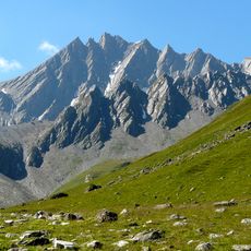
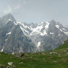
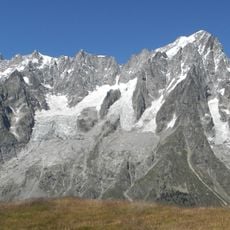
Grande Rochère is a 3,326-metre mountain of the Italian Pennine Alps, in the Aosta Valley north of Morgex. It is the culminating point of the group between Col Ferret and the Great St Bernard Pass. A triangular iron pillar carrying the IGM primary-network geodetic point 028903 Grande Rochere stands on the summit.
The sources document no first ascent, climbers or 1832 expedition for Grande Rochère. Its recorded history is cartographic: the summit carries the primary-network IGM geodetic point 028903 Grande Rochere, fixed on a triangular-section iron pillar. The mountain rises to 3,326 m in the Pennine Alps above La Salle, and the usual route starts from the hamlet of Planaval.
The name Grande Rochère is a French toponym, pronounced [ɡʁɑ̃d ʁɔʃɛʁ], used in the Italian comune of La Salle where the mountain stands. The summit carries the primary IGM geodetic point 028903 Grande Rochere, marked by a triangular-section iron pillar that surveyors and hikers can look for at the top.
Access is through a marked trail from Planaval village on a technical route rated EEA/F+ that requires standard mountaineering equipment. The climb demands alpine experience and proper preparation before attempting the ascent.
On the summit stands a triangular-section iron pillar carrying the primary IGM geodetic point 028903 Grande Rochere. The peak is the culminating point of the group between Col Ferret and the Great St Bernard Pass, north of Morgex in La Salle commune.
The community of curious travelers
AroundUs brings together thousands of curated places, local tips, and hidden gems, enriched daily by 93,230 contributors worldwide.