Pulicchio di Gravina, Karst doline in Gravina in Puglia, Italy
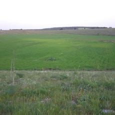
Pulicchio di Gravina is a karst doline in the territory of Gravina in Puglia, about 10 km north of the town at 535 m above sea level, near the SP 238. It is the second-largest doline of the Murge after the Pulo di Altamura: an ovoid basin 530 m long NNW-SE, 400 m wide in the north and 360 m in the south, with a perimeter of about 1,600 m and a maximum depth of 87 m. Its lowest point lies at 477.5 m, and the slopes are almost constant on every side, with no caves in its walls.
Scientific study of this geological formation began in 1917 when geologist Carmelo Colamonico conducted detailed research into its structure and how it formed. His work established the foundation for understanding this natural cavity in the Murge landscape.
Locals call it u pulìcchie in dialect, and the term pulo, of unknown origin, is used only on the Murge plateau for such dolines. It is attested since 1688, when Domenico Santoro wrote of Pulo di Altamura: "luogo detto dalli cittadini lo Pulo". Farmers here say water is never seen at the bottom of the pulicchio.
Access to the site follows a gravel path about 1.7 kilometers long that starts from the SP238 road between Altamura and Corato. The trail circles the rim, allowing visitors to view the formation from different angles as they walk.
Carmelo Colamonico's 1917 photographs show the doline floor completely bare of trees; the woodland inside it dates only from a reforestation carried out in the 1950s. Older maps name the site differently: the late-19th-century Istituto Geografico Militare map labels it "Pulicchie", and a Touring Club Italiano map at 1:250,000 even printed "Policchio".
The community of curious travelers
AroundUs brings together thousands of curated places, local tips, and hidden gems, enriched daily by 93,004 contributors worldwide.