Enable Location

We need your location to show you interesting places around you

Discover nearby places

Find interesting locations and hidden gems around you

Precise directions

Get accurate directions and distances to places

Your location is never shared with other users. It's only used when you tap the location button.

Tokyo Bay Aqua-Line

Log in to your account

Start exploring — it's free

Trusted by 62,830 travelers worldwide

Continue with Google
Continue with Apple
or

We will send you a code to connect

By continuing, you accept our Terms and Conditions and our Privacy Policy

Check your inbox

We've sent a pincode in your inbox. Please enter the code below.

Tokyo Bay Aqua-Line

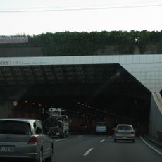
Tokyo Bay Aqua-Line, Bridge-tunnel highway in Kawasaki, Japan.

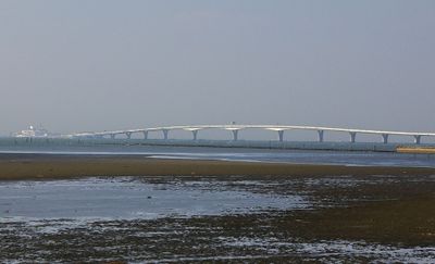
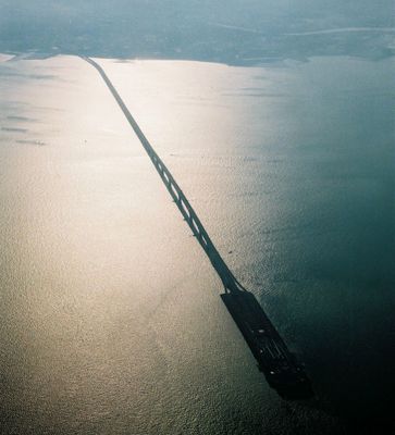
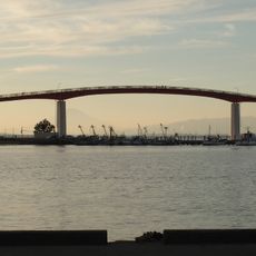
Tokyo Bay Aqua-Line is a highway crossing Tokyo Bay between Kawasaki and Kisarazu through an underwater tunnel and bridge combination. The route runs for 15.1 kilometers and carries four traffic lanes that could be widened to six in the future.

Construction started in 1986 and required engineers to develop new tunneling methods for the soft seabed and deep water. The tunnel reaches 60 meters below sea level, excavated with shield machines measuring 14 meters in diameter.

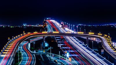
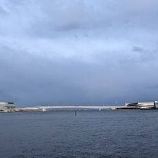
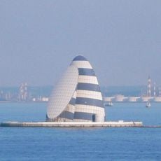
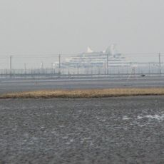
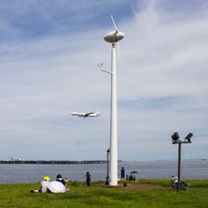
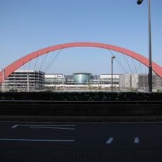
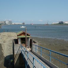
The Umihotaru rest area, positioned at the junction between tunnel and bridge sections, functions as a maritime observation point for Tokyo Bay marine activities.

The highway cuts travel time between Kawasaki and Kisarazu from 90 minutes to 30 minutes. The Umihotaru rest area sits at the midpoint and offers views across the bay.

At Umihotaru there is a small museum with exhibits showing the construction techniques and the creation story of the roadway. Visitors can view models of the tunneling machines and photographs from the building phases.

The community of curious travelers

AroundUs brings together thousands of curated places, local tips, and hidden gems, enriched daily by 60,000 contributors worldwide.

Start exploring
Location
Location
Inception
October 1, 1986
Official opening
December 18, 1997
Width
22.9 m
Part of
3環状9放射, Japan National Route 409
GPS coordinates
35.46306,139.87528
Latest update
December 12, 2025 20:18
« Tokyo Bay Aqua-Line - Bridge-tunnel highway in Kawasaki, Japan » is provided by Around Us (aroundus.com). Images and texts are derived from Wikimedia project under a Creative Commons license. You are allowed to copy, distribute, and modify copies of this page, under the conditions set by the license, as long as this note is clearly visible.

Discover hidden gems everywhere you go!

From secret cafés to breathtaking viewpoints, skip the crowded tourist spots and find places that match your style. Our app makes it easy with voice search, smart filtering, route optimization, and insider tips from travelers worldwide. Download now for the complete mobile experience.

Around Us App Screenshot

A unique approach to discovering new places

Le Figaro

All the places worth exploring

France Info

A tailor-made excursion in just a few clicks

20 Minutes

Around Us
Travel Guide & Maps
Download

Send to your phone

QR Code
1

Open the camera app on your mobile.

2

Point at the QR code with your camera. A notification will appear.

3

Tap the notification to open the link.