Enable Location

We need your location to show you interesting places around you

Discover nearby places

Find interesting locations and hidden gems around you

Precise directions

Get accurate directions and distances to places

Your location is never shared with other users. It's only used when you tap the location button.

Saimaluu-Tash

Log in to your account

Start exploring — it's free

Trusted by 62,827 travelers worldwide

Continue with Google
Continue with Apple
or

We will send you a code to connect

By continuing, you accept our Terms and Conditions and our Privacy Policy

Check your inbox

We've sent a pincode in your inbox. Please enter the code below.

Saimaluu-Tash, Ancient petroglyph site in Jalal-Abad Region, Kyrgyzstan.

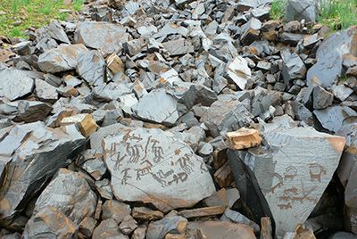
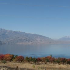
Saimaluu-Tash is an archaeological site at 3,200 meters elevation in the Ferghana Range containing over 10,000 petroglyphs carved into rock faces across two high valleys separated by a mountain ridge. The engravings are scattered throughout the terrain and can be explored on foot along established trails through the highland landscape.

The rock carvings were created between 2000 BCE and the Middle Ages, documenting human creativity across a very long time span. Russian cartographers discovered the site in 1902 during a mapping expedition, which prompted the first scientific investigations.

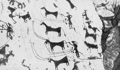
The rock carvings depict hunting expeditions, ritual dances, and sun-headed figures that reveal early religious beliefs of the people who lived in this region. Visitors can directly experience the spiritual world and daily activities of ancient cultures through these rock faces.

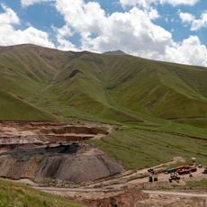
Reaching this location requires a four-wheel drive vehicle departing from Kazarman village, then a demanding hike across mountainous terrain at high altitude. Visitors should prepare for variable weather, rough mountain paths, and full-day excursions.

The collection features anthropomorphic figures with radiating or illuminated heads that have drawn special scholarly attention in archaeological research. The carvings also show the cultural shift from using oxen-drawn vehicles to horseback riding during the Bronze Age.

The community of curious travelers

AroundUs brings together thousands of curated places, local tips, and hidden gems, enriched daily by 60,000 contributors worldwide.

Start exploring
Elevation above the sea
3,200 m
GPS coordinates
41.18096,73.81277
Latest update
December 6, 2025 16:04
Photogenic locations in Kyrgyzstan

Kyrgyzstan offers photographers mountains, lakes and historic structures. The landscape ranges from the peaks of the Terskey Alatau Mountains to the shores of Lake Issyk-Kul, one of the largest alpine lakes in the world. In Ala Archa National Park, hiking trails lead through narrow valleys to...

« Saimaluu-Tash - Ancient petroglyph site in Jalal-Abad Region, Kyrgyzstan » is provided by Around Us (aroundus.com). Images and texts are derived from Wikimedia project under a Creative Commons license. You are allowed to copy, distribute, and modify copies of this page, under the conditions set by the license, as long as this note is clearly visible.

Discover hidden gems everywhere you go!

From secret cafés to breathtaking viewpoints, skip the crowded tourist spots and find places that match your style. Our app makes it easy with voice search, smart filtering, route optimization, and insider tips from travelers worldwide. Download now for the complete mobile experience.

Around Us App Screenshot

A unique approach to discovering new places

Le Figaro

All the places worth exploring

France Info

A tailor-made excursion in just a few clicks

20 Minutes

Around Us
Travel Guide & Maps
Download

Send to your phone

QR Code
1

Open the camera app on your mobile.

2

Point at the QR code with your camera. A notification will appear.

3

Tap the notification to open the link.