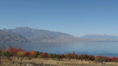
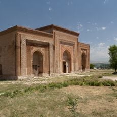
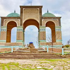
Toktogul Reservoir, Artificial lake in Toktogul District, Kyrgyzstan.
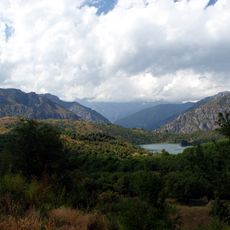
Toktogul Reservoir is a large artificial lake in a mountainous region of Central Asia, surrounded by steep slopes and situated in a dramatic valley setting. The basin was created by damming a river and captures water from the surrounding mountains.
This project originated in the mid-20th century as part of major infrastructure development across the region. The dam construction transformed the landscape significantly and brought substantial changes to surrounding communities.
The reservoir carries the name of a historical figure from the region and serves as a vital space for local communities who depend on fishing and daily water-related activities. The waters hold significance for the livelihoods and routines of people living nearby.
The water here remains quite cold and shorelines can be steep and rocky, so sturdy footwear is essential for exploring around the basin. Access is most feasible during warmer months when mountain passes are open and conditions are more favorable.
The waters power multiple power stations and play a central role in generating electricity for the entire region. This dual function as an energy source and fishing ground makes it a distinctive site in the mountain landscape.
Location: Toktogul District
GPS coordinates: 41.80640,72.87420
Latest update: December 6, 2025 17:40
Olana State Historic Site
10104.7 km
Kempir-Abad reservoir
116.8 km
Saimaluu-Tash
104.7 km
Vladimir Putin Peak
129.2 km
Sary-Chelek Nature Reserve
74.4 km
Manas Ordo
89.7 km
Uzgen Minaret
121.1 km
Padyshata State Nature Reserve
108 km
Church in Andijan
124.6 km
Church of St. Archangel Michael in Namangan 1952
133.8 km
Church of St. Nicholay Chudotvortsa in Andijan
124.5 km
Chapel of St. George in Andijan
123.9 km
Mausoleen von Ösgön
120.9 km
Church of St. Sergiy Radonezhckogo in Andijan
124 km
Shah Fazil Mausoleum
109.5 km
Ak-Kur
42.3 km
Rodnik Kara-Bulak (tubud sa Kirgistan, Jalal-Abad oblast, lat 41,17, long 72,69)
72.9 km
Rodnik Sasyk-Bulak (tubud sa Kirgistan, Jalal-Abad oblast, lat 41,14, long 72,81)
74.4 km
Akkurgan
40.9 km
Rodnik Burzhu-Bulak
88.2 km
Rodnik Kayragach-Bulak
75.4 km
Aryk Yangi
136.5 km
Rodnik Kara-Suu
123.8 km
Rodnik Kara-Bulak (tubud sa Kirgistan, Jalal-Abad oblast, lat 41,61, long 71,99)
76.9 km
Rodnik Kosh-Bulak
80 km
Rodnik Ak-Tash (tubud sa Kirgistan, Jalal-Abad oblast)
74.7 km
Rodnik Kyzyl-Alma
71.6 km
Rodnik Tashbulak (tubud sa Kirgistan, Talas)
112.9 kmVisited this place? Tap the stars to rate it and share your experience / photos with the community! Try now! You can cancel it anytime.
Discover hidden gems everywhere you go!
From secret cafés to breathtaking viewpoints, skip the crowded tourist spots and find places that match your style. Our app makes it easy with voice search, smart filtering, route optimization, and insider tips from travelers worldwide. Download now for the complete mobile experience.
A unique approach to discovering new places❞
— Le Figaro
All the places worth exploring❞
— France Info
A tailor-made excursion in just a few clicks❞
— 20 Minutes