Enable Location

We need your location to show you interesting places around you

Discover nearby places

Find interesting locations and hidden gems around you

Precise directions

Get accurate directions and distances to places

Your location is never shared with other users. It's only used when you tap the location button.

Trans-Alay Range

Log in to your account

Start exploring — it's free

Trusted by 61,744 travelers worldwide

Continue with Google
Continue with Apple
or

We will send you a code to connect

By continuing, you accept our Terms and Conditions and our Privacy Policy

Check your inbox

We've sent a pincode in your inbox. Please enter the code below.

Trans-Alay Range

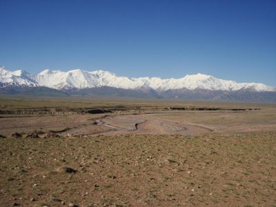
Trans-Alay Range, Mountain range between Kyrgyzstan and Tajikistan

Description

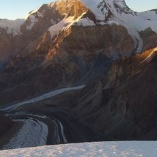
The Trans-Alay Range stretches roughly 350 kilometers along the border between Kyrgyzstan and Tajikistan, with many peaks rising above 6,000 meters. The mountains consist of limestone and schist, which have been shaped into jagged and angular forms by wind and weather.

History

The range formed through tectonic collisions during the Paleozoic and Mesozoic eras, when continental plates pushed together to create mountain belts. These ancient geological events shaped the landscape that people in the region have inhabited for centuries.

Culture

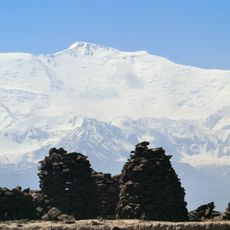
The range shapes life for herders in nearby valleys, who still move their animals between higher and lower pastures depending on the season. This way of living remains visible in small settlements tucked into the mountainsides.

Practical

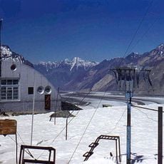
The Pamir Highway crosses through the Kyzyl-Art Pass at about 4,280 meters (14,040 feet), which is the main road link between Osh in Kyrgyzstan and Khorog in Tajikistan. The route is passable but can be challenging depending on the season, so planning ahead for weather conditions is advisable.

Did you know?

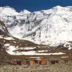
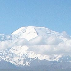
Ibn Sina Peak rises to about 7,134 meters as the highest point, named after the famous Persian scholar, reflecting the intellectual importance the region holds in Central Asia. Climbers from around the world come to this summit, though it remains less famous than other Asian mountains of similar height.

Elevation above the sea
7,134 m
GPS coordinates
39.33333,72.91667
Latest update
December 6, 2025 17:43

AroundUs brings together thousands of curated places, local tips, and hidden gems, enriched daily by 60,000 contributors worldwide. Discover all places nearby (Kyrgyzstan, Tajikistan).

Photogenic locations in Kyrgyzstan

Kyrgyzstan offers photographers mountains, lakes and historic structures. The landscape ranges from the peaks of the Terskey Alatau Mountains to the shores of Lake Issyk-Kul, one of the largest alpine lakes in the world. In Ala Archa National Park, hiking trails lead through narrow valleys to...

« Trans-Alay Range - Mountain range between Kyrgyzstan and Tajikistan » is provided by Around Us (aroundus.com). Images and texts are derived from Wikimedia project under a Creative Commons license. You are allowed to copy, distribute, and modify copies of this page, under the conditions set by the license, as long as this note is clearly visible.

Discover hidden gems everywhere you go!

From secret cafés to breathtaking viewpoints, skip the crowded tourist spots and find places that match your style. Our app makes it easy with voice search, smart filtering, route optimization, and insider tips from travelers worldwide. Download now for the complete mobile experience.

Around Us App Screenshot

A unique approach to discovering new places

Le Figaro

All the places worth exploring

France Info

A tailor-made excursion in just a few clicks

20 Minutes

Around Us
Travel Guide & Maps
Download

Send to your phone

QR Code
1

Open the camera app on your mobile.

2

Point at the QR code with your camera. A notification will appear.

3

Tap the notification to open the link.