Katon-Karagay National Park
Katon-Karagay National Park, National park in East Kazakhstan Region, Kazakhstan
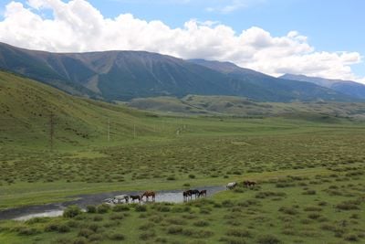
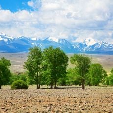
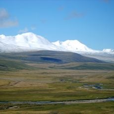
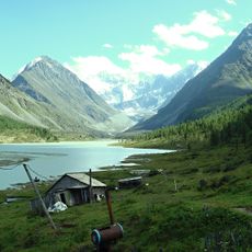
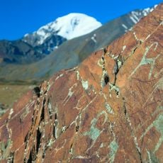
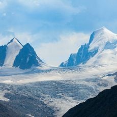
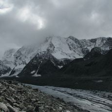
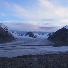
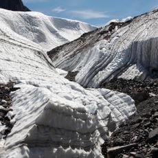
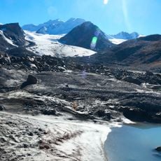
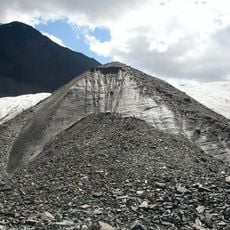
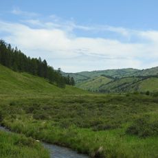
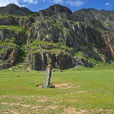
Katon-Karagay National Park is a protected area spanning roughly 643,000 hectares across the Altai Mountains, featuring mountain ranges, dense forests, alpine lakes, and glaciers. The park sits at the meeting point where Kazakhstan, Russia, China, and Mongolia converge, creating a landscape shaped by these regional borders.
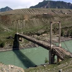
During World War I, Austro-Hungarian prisoners constructed a 60-kilometer road through the mountain terrain between 1915 and 1917. This wartime construction project left a lasting mark on how the territory could be accessed and traversed.
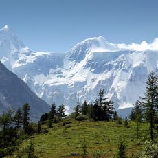
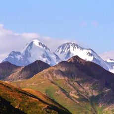
Mount Belukha holds sacred meaning for Siberian shamans and Tibetan Buddhists who journey here as part of their spiritual practices. The mountain's role in these traditions shapes how visitors understand the landscape today.
The park is best reached through Oskemen city, which has flights from major Kazakh cities and serves as the main hub for getting to the area. From there, visitors should prepare for mountain trails and changing weather conditions.
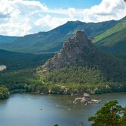
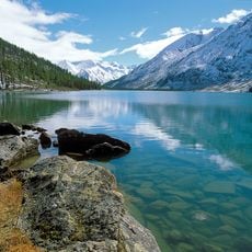
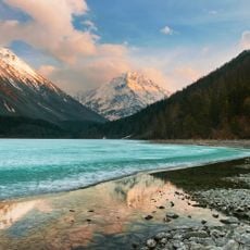
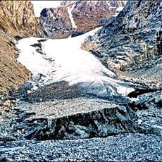
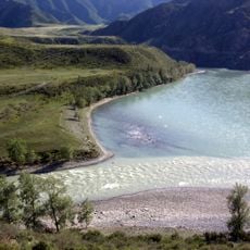
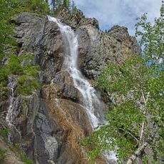
The park contains Lake Yazevoe at 1,685 meters altitude and Kokkol waterfall plunging over 80 meters near a former tungsten and molybdenum mining site. These natural features sit quietly today, yet their location reveals the region's past relationship with resource extraction.
Location: East Kazakhstan Region
Inception: July 17, 2001
Address: 070000, Kazakhstan
GPS coordinates: 49.26422,86.44592
Latest update: December 6, 2025 17:41
Kazakhstan stretches across an impressive variety of landscapes, from high mountains to vast steppes, from hidden mountain lakes to wide desert plains. The country protects numerous natural areas that show these differences and allow visitors to experience places that remain little changed. In the national parks and reserves, you can walk through forests, stand by quiet lakes, or explore canyons shaped over thousands of years. Among the most visited are Charyn Canyon with its red rock walls, Burabay National Park with its pine forests and granite boulders, and Big Almaty Lake, which sits in a narrow valley at over 2500 meters elevation. Kaindy Lake is known for its submerged trees, their trunks still rising from the water. In the southern regions you find Aksu-Zhabagly, the country's oldest nature reserve, while in the east Mount Belukha, the highest peak of the Altai range, stands on the border with Russia. Each of these places offers its own picture of what nature looks like in this part of Central Asia.
Belukha Mountain
61.3 km
Pazyryk burials
128.5 km
Markakol State Nature Reserve
76.5 km
Golden Mountains of Altai
137.6 km
Katun Nature Reserve
45.9 km
Hüiten Peak
100.6 km
Akkem
71.9 km
Lake Kucherla
68.1 km
Inya Bridge
133.4 km
Kalbak-Tash
129.4 km
Gebler Glacier
57.3 km
Petroglyphs of the Yelangash Valley
135.2 km
Nature Park Ukok
76.9 km
Малый Актуру
128.7 km
Sofia Glacier
112.5 km
Begemot Rapid
133.1 km
Lednik Akkem
63.9 km
Potanin Glacier
108.1 km
Gorizont Rapid
128.8 km
Chuya and Katun Rivers Confluence
126.9 km
Shirlak Waterfall
132.4 km
Turbinny Rapid
129 km
Maashei glacier
124 km
Большая Талдура
108.8 km
Irbistu
132.5 km
Велика Білобомська печера
130.4 km
State Nature Sanctuary "South Altay"
91.3 km
Chuysky deer stone, Iodro
131.1 kmReviews
Visited this place? Tap the stars to rate it and share your experience / photos with the community! Try now! You can cancel it anytime.
Discover hidden gems everywhere you go!
From secret cafés to breathtaking viewpoints, skip the crowded tourist spots and find places that match your style. Our app makes it easy with voice search, smart filtering, route optimization, and insider tips from travelers worldwide. Download now for the complete mobile experience.
A unique approach to discovering new places❞
— Le Figaro
All the places worth exploring❞
— France Info
A tailor-made excursion in just a few clicks❞
— 20 Minutes