Chest opened
+${chestReward.xp} XP
Explorer
NOUVEAU ×${chestReward.collectible.quantity}
tapez pour fermer

See the monuments around you in AR Open chests in the app

Around Us is built for your phone — point your camera at the streets and discover the monuments and places around you in augmented reality. Around Us is built for your phone — chests unlock when you walk, explore and capture nearby places.

•

Enable Location

We need your location to show you interesting places around you

Discover nearby places

Find interesting locations and hidden gems around you

Precise directions

Get accurate directions and distances to places

Your location is never shared with other users. It's only used when you tap the location button.

Mihintale

Log in to your account

Start exploring — it's free

Trusted by 93,469 travelers worldwide

Continue with Google
Continue with Apple
or

We will send you a code to connect

By continuing, you accept our Terms and Conditions and our Privacy Policy

Check your inbox

We've sent a pincode in your inbox. Please enter the code below.

Mihintale

Mihintale, Sacred Buddhist mountain peak near Anuradhapura, Sri Lanka

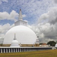
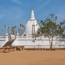
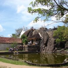
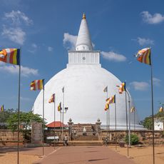
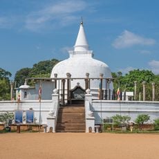
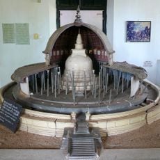
Mihintale is a 300-metre peak of the Missaka Pabbata range, 12.5 km east of Anuradhapura. A granite stairway of 1,840 steps climbs its eastern slope in four sections, passing the ruins of a hospital and monastery before reaching the Kantaka Cetiya, a circular stupa with a base circumference of about 425 feet and four decorated frontispieces. The summit holds the Maha Seya, built by King Mahadathika Mahanaga with a diameter of 136 feet.

According to the Mahavamsa, Mahinda, son of Emperor Ashoka, met King Devanampiyatissa on the full moon of Poson in the 3rd century BCE; the king then built a vihara and 68 caves for monks. The Maha Seya on the summit was built by King Mahadathika Mahanaga with a diameter of 136 feet. The Kantaka Cetiya is attributed to King Suratissa, and the Mihindu Seya, built by King Uttiya (210–200 BCE), is among the island's oldest stupas.

The Sinhala name Mihin-Thalé means "plateau of Mihindu", after the monk said to have called King Devanampiyatissa by name to stop him shooting a deer. Every Poson full moon, pilgrims climb to the summit where Mahinda preached the Chullahatthipadopama Sutta. The Kantaka Cetiya's four frontispieces carry an elephant on the east, a lion on the north, a horse on the west and a bull on the south.

The climb is steep and requires sturdy shoes and plenty of water, especially on warm days. Starting early in the morning or visiting in the late afternoon helps you avoid the strongest heat while ascending.

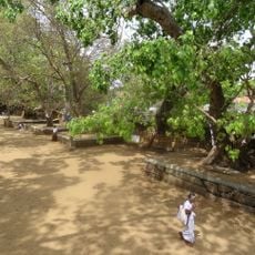
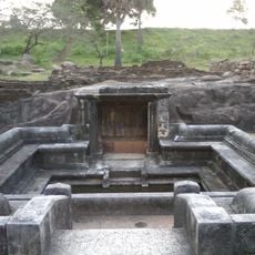
At the foot of the mountain lie the ruins of a hospital that Heinz E. Müller-Dietz (Historia Hospitalium, 1975) called perhaps the oldest in the world. Beside it is a stone canoe in which patients were bathed in medicinal oil, and urns and a stone inscription were unearthed there.

The community of curious travelers

AroundUs brings together thousands of curated places, local tips, and hidden gems, enriched daily by 93,469 contributors worldwide.

Start exploring
GPS coordinates
8.35059,80.51695
Latest update
November 1, 2026 03:29
Reviews
Share your experience

No review yet

Discussions
Start a discussion...

No discussion yet

« Mihintale - Sacred Buddhist mountain peak near Anuradhapura, Sri Lanka » is provided by Around Us (aroundus.com). Images and texts are derived from Wikimedia project under a Creative Commons license. You are allowed to copy, distribute, and modify copies of this page, under the conditions set by the license, as long as this note is clearly visible.

Discover hidden gems everywhere you go!

From secret cafés to breathtaking viewpoints, skip the crowded tourist spots and find places that match your style. Our app makes it easy with voice search, smart filtering, route optimization, and insider tips from travelers worldwide. Download now for the complete mobile experience.

Around Us App Screenshot
❝

A unique approach to discovering new places❞

— Le Figaro

❝

All the places worth exploring❞

— France Info

❝

A tailor-made excursion in just a few clicks❞

— 20 Minutes

Around Us
Travel Guide & Maps
Download

Send to your phone

QR Code
1

Open the camera app on your mobile.

2

Point at the QR code with your camera. A notification will appear.

3

Tap the notification to open the link.