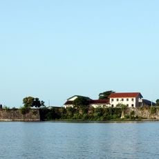
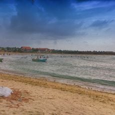
Batticaloa Lagoon, Coastal lagoon in Eastern Province, Sri Lanka
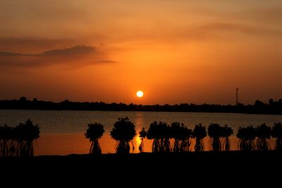
Batticaloa Lagoon is an extensive water body along Sri Lanka's eastern coast connected to the Indian Ocean through two openings. The lagoon stretches for considerable distances and creates important fishing grounds and waterways throughout the region.
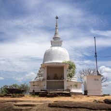
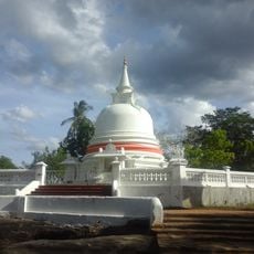
The lagoon has been shaped by colonial powers since the 17th century, when Portuguese and later Dutch forces built fortifications along its shores. These structures were part of broader colonial strategies for control of the eastern coast.
Local fishing families have depended on these waters for generations, shaping daily routines and community life along the shoreline. The lagoon remains central to how people here earn their living and spend their time.
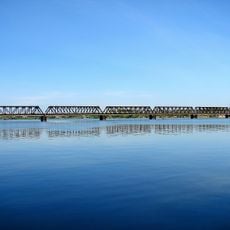
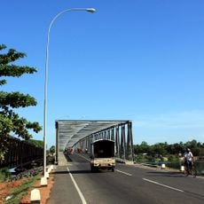
The lagoon is best explored from surrounding towns, with the Kallady Bridge providing key crossings over the water. Visitors should be aware that weather and tidal currents can affect activities on the water.
At night, unusual sounds emerge from the lagoon waters, attributed to the phenomenon of singing fish. This mysterious natural occurrence has drawn attention to the lagoon for many years.
GPS coordinates: 7.56667,81.68333
Latest update: December 6, 2025 17:42
Sri Lanka offers diverse photography sites spanning ancient fortresses, temples, and natural landscapes. Sigiriya Rock stands as a dramatic stone fortress surrounded by green valleys, while Polonnaruwa showcases ruins of an ancient kingdom. Buddhist temples like Dambulla Cave Temple and the Temple...
Zion Church, Batticaloa
16 km
Deeghawapi
33.5 km
Kallady Bridge
17.2 km
Batticaloa Fort
16.3 kmValaichchenai Paper Mill
44.6 km
Church of Our Lady of Presentation, Batticaloa
17.1 km
Oluvil Lighthouse
36.8 km
Batticaloa Lighthouse
20.9 km
Oddamavadi Bridge
43.6 km
Piyangala Forest Hermitage
9.7 km
Batticaloa Gate
16.4 km
Batticaloa Museum
16.3 km
Gonagolla Vihara
17.1 km
Samangala Forest Hermitage
20.7 km
Galmaduwa Raja Maha Vihara, Ampara
33.9 km
Uththara Jayamaha Vihara
38.4 km
Sri Dharmendrarama Raja Maha Vihara
16.5 km
Ovagiriya
40.4 km
Muwangala Raja Maha Vihara
35.3 km
Samanabedda cave temple
25.2 km
Udayagiri Raja Maha Vihara
21.3 kmKondavattavan Kulam
32 kmRugam
23 kmKaradiyan Tank
23.4 kmNamal Oya Reservoir
36.5 kmKarungkoddluvu Kulam
42.4 kmIrakkamam Tank
35.7 km
Pasikudah Beach
42.6 kmVisited this place? Tap the stars to rate it and share your experience / photos with the community! Try now! You can cancel it anytime.
Discover hidden gems everywhere you go!
From secret cafés to breathtaking viewpoints, skip the crowded tourist spots and find places that match your style. Our app makes it easy with voice search, smart filtering, route optimization, and insider tips from travelers worldwide. Download now for the complete mobile experience.
A unique approach to discovering new places❞
— Le Figaro
All the places worth exploring❞
— France Info
A tailor-made excursion in just a few clicks❞
— 20 Minutes