Chest opened
+${chestReward.xp} XP
Explorer
NOUVEAU ×${chestReward.collectible.quantity}
tapez pour fermer
Chest locked

Open chests in the app

Around Us is built for your phone — chests unlock when you walk, explore and capture nearby places.

Enable Location

We need your location to show you interesting places around you

Discover nearby places

Find interesting locations and hidden gems around you

Precise directions

Get accurate directions and distances to places

Your location is never shared with other users. It's only used when you tap the location button.

Kita Cercle

Log in to your account

Start exploring — it's free

Trusted by 72,885 travelers worldwide

Continue with Google
Continue with Apple
or

We will send you a code to connect

By continuing, you accept our Terms and Conditions and our Privacy Policy

Check your inbox

We've sent a pincode in your inbox. Please enter the code below.

Discussion Reviews 1 Photos
5.2k Popularity

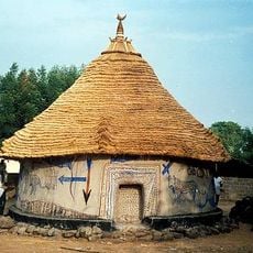
Kita Cercle, Administrative territorial entity in Kayes Region, Mali.

Kita Cercle is an administrative district in the Kayes Region of western Mali. The territory spans 25 communes, including Badia, Bendougouba, and Kassaro, situated at an elevation of approximately 364 meters.

The district was established under French colonial rule as a governance unit organizing multiple cantons and villages under European administration. Following independence, the territory retained its original French administrative designation, unlike many other former colonies that renamed their divisions.

The territory maintains traditional Malinke governance structures alongside modern administrative systems, reflecting the evolution of local leadership and community organization.

Visitors should know this lies in western Mali in a sparsely populated region. Access to the various communes may vary depending on seasonal conditions and road infrastructure.

The cercle administration preserved its original French colonial designation after independence, unlike other former colonies that transitioned to different administrative names.

The community of curious travelers

AroundUs brings together thousands of curated places, local tips, and hidden gems, enriched daily by 60,000 contributors worldwide.

Start exploring
Location
Elevation above the sea
364 m
Address
Kita, Mali
GPS coordinates
13.25000,-9.33333
Latest update
December 10, 2025 16:28
Reviews
Share your experience

No review yet

Discussions
Start a discussion...

No discussion yet

« Kita Cercle - Administrative territorial entity in Kayes Region, Mali » is provided by Around Us (aroundus.com). Images and texts are derived from Wikimedia project under a Creative Commons license. You are allowed to copy, distribute, and modify copies of this page, under the conditions set by the license, as long as this note is clearly visible.

Discover hidden gems everywhere you go!

From secret cafés to breathtaking viewpoints, skip the crowded tourist spots and find places that match your style. Our app makes it easy with voice search, smart filtering, route optimization, and insider tips from travelers worldwide. Download now for the complete mobile experience.

Around Us App Screenshot

A unique approach to discovering new places

Le Figaro

All the places worth exploring

France Info

A tailor-made excursion in just a few clicks

20 Minutes

Around Us
Travel Guide & Maps
Download

Send to your phone

QR Code
1

Open the camera app on your mobile.

2

Point at the QR code with your camera. A notification will appear.

3

Tap the notification to open the link.