Mali, Landlocked country in West Africa
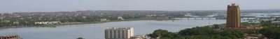
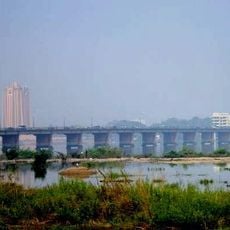
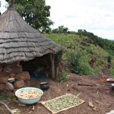
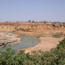
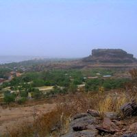
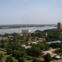
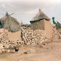
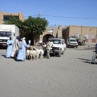
This West African republic extends from the Sahara in the north to the river plains of the Niger in the south, where the capital Bamako and most settlements are located. The landscape shifts between desert expanses, savanna grasslands, and fertile zones along the waterways that shape agriculture and daily life.
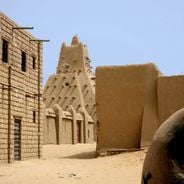
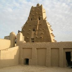
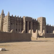
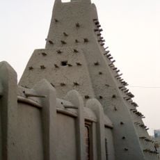
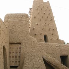
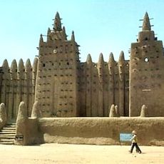
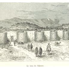
From the eighth to the sixteenth century, the region was the heartland of three major empires: Ghana, then Mali under Mansa Musa in the fourteenth century, and finally Songhai until the Moroccan conquest in 1591. French colonial rule began in the nineteenth century and ended with independence in 1960.
Musical traditions shape West African culture through griots, professional storytellers and musicians who preserve genealogies and historical narratives across generations, maintaining oral heritage central to community identity.
French is the official administrative language, while Bambara is the most widely spoken language in commerce and everyday settings. Travelers need a visa and should check security conditions before departure, as some northern areas remain unstable.
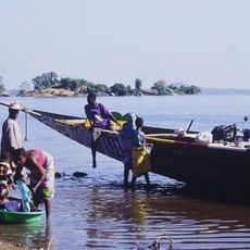
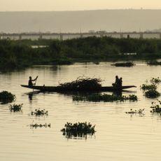
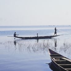
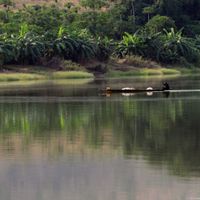
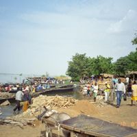
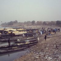
The inland delta of the Niger in the center forms a sprawling network of channels and shallow lakes during the rainy season, drawing thousands of fishermen and herders. This annual flooding enables rice farming in an otherwise dry area and shapes the rhythm of life for entire villages along the banks.
Inception: September 22, 1960
Capital city: Bamako
Part of: West Africa
Shares border with: Algeria, Niger, Burkina Faso, Ivory Coast, Guinea, Senegal, Mauritania
Website: http://primature.gov.ml
GPS coordinates: 16.37004,-2.29002
Latest update: December 12, 2025 18:53
Mali's landscape tells stories through its buildings and nature. In cities like Timbuktu, Djenné, and Gao, you will find striking mud-brick structures that have stood for centuries. These are not just buildings—they are centers of learning, prayer, and daily life where communities have gathered for...
Timbuktu
88 km
Great Mosque of Djenné
366.8 km
Sankore Madrasah
88.7 km
Djinguereber Mosque
88.9 km
Djenné-Djenno
367 km
Bandiagara Escarpment
243.8 km
Tomb of Askia
240.1 km
Stade du 26 Mars
737.5 km
Sidi Yahya Mosque
88.7 km
Martyrs Bridge
742.1 km
Sélingué Dam
829.9 km
Mount Tenakourou
710.5 km
National Museum of Mali
741 km
Embassy of France, Bamako
742 km
Bamako Grand Mosque
741.2 km
Grand Marché
741.7 km
King Fahd Bridge
743.7 km
Boucle du Baoulé National Park
752.5 km
BCEAO Tower
742.6 km
Sikasso tata
671.2 km
Mezquita de Kankou Moussa de Gao
240.9 km
Palais de la Culture Amadou Hampaté Ba
742.4 km
Ounjougou
218.2 km
Gouina Falls
982.2 km
Old Towns of Djenné
366.7 km
Lake Sélingué
831.8 km
National Library of Mali
744.1 km
Bafing National Park
959.9 kmVisited this place? Tap the stars to rate it and share your experience / photos with the community! Try now! You can cancel it anytime.
Discover hidden gems everywhere you go!
From secret cafés to breathtaking viewpoints, skip the crowded tourist spots and find places that match your style. Our app makes it easy with voice search, smart filtering, route optimization, and insider tips from travelers worldwide. Download now for the complete mobile experience.
A unique approach to discovering new places❞
— Le Figaro
All the places worth exploring❞
— France Info
A tailor-made excursion in just a few clicks❞
— 20 Minutes