Enable Location

We need your location to show you interesting places around you

Discover nearby places

Find interesting locations and hidden gems around you

Precise directions

Get accurate directions and distances to places

Your location is never shared with other users. It's only used when you tap the location button.

Nat Ma Taung

Log in to your account

Start exploring — it's free

Trusted by 62,938 travelers worldwide

Continue with Google
Continue with Apple
or

We will send you a code to connect

By continuing, you accept our Terms and Conditions and our Privacy Policy

Check your inbox

We've sent a pincode in your inbox. Please enter the code below.

Nat Ma Taung
Discussion Reviews 1 Photos 1 Collections
7.7k Popularity

Nat Ma Taung, Protected mountain in Chin State, Myanmar.

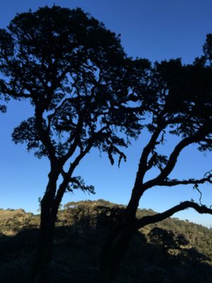
Nat Ma Taung is a mountain in Chin State featuring steep slopes covered in dense forests across multiple elevation zones. The landscape transitions from tropical vegetation at lower levels to temperate plant communities toward the summit.

The mountain became a national park in 1994, establishing formal protection for the forest region. This designation marked a significant conservation effort for the landscape and its ecosystems.

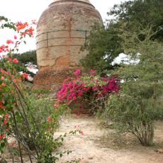
Local communities blend Christian and animist beliefs in their daily spiritual practices. Older women display traditional facial tattoos that reflect family heritage and cultural identity passed down through generations.

The hiking trail starts near Kanpetlet town and follows marked paths to the summit. Visitors should plan for several hours of walking with elevation changes, so bring adequate water and wear appropriate footwear.

The mountain hosts hundreds of bird species, including the White-browed Nuthatch found in the high forests. The summit region also supports a remarkable diversity of moss species and plants that grow nowhere else on earth.

The community of curious travelers

AroundUs brings together thousands of curated places, local tips, and hidden gems, enriched daily by 60,000 contributors worldwide.

Start exploring
Location
Elevation above the sea
3,070 m
Part of
Chin Hills, Arakan Mountains
GPS coordinates
21.23386,93.90256
Latest update
December 6, 2025 17:40
Myanmar for photographers

Myanmar offers photographers an exceptional range of subjects, from ancient temple complexes to natural landscapes. The archaeological zone of Bagan, with more than 2,000 pagodas and temples spread across 40 square miles (104 square kilometers), ranks among Southeast Asia's most significant...

Reviews
Share your experience

No review yet

Discussions
Start a discussion...

No discussion yet

« Nat Ma Taung - Protected mountain in Chin State, Myanmar » is provided by Around Us (aroundus.com). Images and texts are derived from Wikimedia project under a Creative Commons license. You are allowed to copy, distribute, and modify copies of this page, under the conditions set by the license, as long as this note is clearly visible.

Discover hidden gems everywhere you go!

From secret cafés to breathtaking viewpoints, skip the crowded tourist spots and find places that match your style. Our app makes it easy with voice search, smart filtering, route optimization, and insider tips from travelers worldwide. Download now for the complete mobile experience.

Around Us App Screenshot

A unique approach to discovering new places

Le Figaro

All the places worth exploring

France Info

A tailor-made excursion in just a few clicks

20 Minutes

Around Us
Travel Guide & Maps
Download

Send to your phone

QR Code
1

Open the camera app on your mobile.

2

Point at the QR code with your camera. A notification will appear.

3

Tap the notification to open the link.