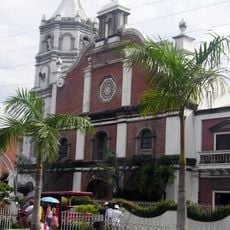
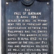
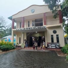
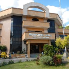
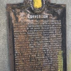
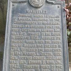
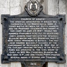
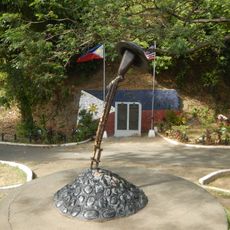
Bagac, municipality of the Philippines in the province of Bataan
Location: Bataan
Inception: 1866
Elevation above the sea: 74 m
Shares border with: Balanga, Mariveles
GPS coordinates: 14.59506,120.39183
Latest update: March 3, 2025 03:10
Mount Samat National Shrine
12.7 km
Mount Samat
12.5 km
Abucay Church
20.9 km
Mount Mariveles
12.2 km
Mount Natib
13 km
Bataan National Park
10.2 km
Balanga Cathedral
18.5 km
Casa Bizantina
643 m
Casa Hidalgo
759 m
Casa Unisan
661 m
Casa Jaen I
759 m
Subic Watershed Forest Reserve
21.2 km
The Fall of Bataan historical marker
17.4 km
Bataan World War II Museum
19.1 km
Mariveles Municipal Hall
20.7 km
Bataan Provincial Capitol
17.3 km
Francisco C. Baltazar (Balagtas) historical marker
21.2 km
Corregidor historical marker
20.8 km
Mariveles historical marker
20.7 km
Cayetano S. Arellano historical marker
20.2 km
Tomas Guillermo T. del Rosario historical marker
17.4 km
Church of Abucay historical marker
20.9 km
The Death March of Filipino and American Prisoners of War from Mariveles and Bagac to Camp O’Donnell, Capas, Tarlac historical markers
20.7 km
Ambon-Ambon Falls
9.1 km
Starting Point of Death March historical marker
541 m
Church of Balanga historical marker
18.6 km
Church of Orion historical marker
20.1 km
World War II Death March Memorial Shrine
20.7 kmReviews
Visited this place? Tap the stars to rate it and share your experience / photos with the community! Try now! You can cancel it anytime.
Discover hidden gems everywhere you go!
From secret cafés to breathtaking viewpoints, skip the crowded tourist spots and find places that match your style. Our app makes it easy with voice search, smart filtering, route optimization, and insider tips from travelers worldwide. Download now for the complete mobile experience.
A unique approach to discovering new places❞
— Le Figaro
All the places worth exploring❞
— France Info
A tailor-made excursion in just a few clicks❞
— 20 Minutes