Enable Location

We need your location to show you interesting places around you

Discover nearby places

Find interesting locations and hidden gems around you

Precise directions

Get accurate directions and distances to places

Your location is never shared with other users. It's only used when you tap the location button.

Makilala

Log in to your account

Start exploring — it's free

Trusted by 62,134 travelers worldwide

Continue with Google
Continue with Apple
or

We will send you a code to connect

By continuing, you accept our Terms and Conditions and our Privacy Policy

Check your inbox

We've sent a pincode in your inbox. Please enter the code below.

Makilala, Municipality in Cotabato Province, Philippines.

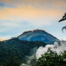
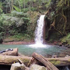
Makilala is a municipality in Cotabato Province covering 343 square kilometers at an elevation of 268 meters. It borders Mount Apo National Park to the southeast and features landscapes shaped by agriculture and mountainous terrain.

This municipality gained independence from Kidapawan on September 8, 1954, through an executive order by President Ramon Magsaysay. This milestone marked the start of its development as a separate administrative unit in Cotabato.

The name comes from three early barangays - Malasila, Kisante, and Lamitan - with an added syllable linked to Hiligaynon language meanings. You can still sense these origins in how local communities maintain their traditions and daily practices.

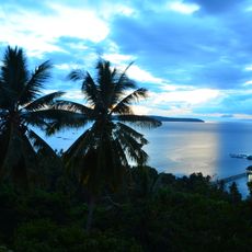
The local economy centers on agriculture, including rubber processing, rice farming, and large-scale banana plantations. Visitors should expect warm, humid weather and rural infrastructure, particularly when traveling to the mountainous areas.

New Israel district houses one of Asia's longest zip-lines, giving visitors a way to explore Mount Apo National Park from above. This unusual attraction offers both a fresh perspective on the landscape and chances to encounter local wildlife.

The community of curious travelers

AroundUs brings together thousands of curated places, local tips, and hidden gems, enriched daily by 60,000 contributors worldwide.

Start exploring
Location
Inception
September 8, 1954
Elevation above the sea
268 m
Shares border with
Kidapawan, Bansalan, Magsaysay
Address
W55F+JC5, Makilala, Cotabato, Philippines
GPS coordinates
6.96667,125.08333
Latest update
December 11, 2025 11:00
« Makilala - Municipality in Cotabato Province, Philippines » is provided by Around Us (aroundus.com). Images and texts are derived from Wikimedia project under a Creative Commons license. You are allowed to copy, distribute, and modify copies of this page, under the conditions set by the license, as long as this note is clearly visible.

Discover hidden gems everywhere you go!

From secret cafés to breathtaking viewpoints, skip the crowded tourist spots and find places that match your style. Our app makes it easy with voice search, smart filtering, route optimization, and insider tips from travelers worldwide. Download now for the complete mobile experience.

Around Us App Screenshot

A unique approach to discovering new places

Le Figaro

All the places worth exploring

France Info

A tailor-made excursion in just a few clicks

20 Minutes

Around Us
Travel Guide & Maps
Download

Send to your phone

QR Code
1

Open the camera app on your mobile.

2

Point at the QR code with your camera. A notification will appear.

3

Tap the notification to open the link.