Matalam, Municipality in Cotabato, Philippines.
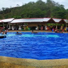
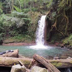
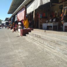
Matalam is a municipality covering around 48,000 hectares in North Cotabato, positioned along the Cotabato-Davao National Highway within the Arakan Valley. The area is divided into 34 barangays and benefits from year-round rainfall that supports farming of rice, corn, and copra.
This municipality was established in 1961 through Executive Order 461 signed by President Carlos P. Garcia as the 32nd municipality of Cotabato Province. It was carved out from the former territory of Crossing M'lang.
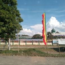
The population brings together Ilonggo, Ilocano, Maguindanaon, and Cebuano speakers who share the territory. The Sallah-Mat Festival on December 29 reflects both Ilocano and Muslim traditions through public celebrations that mark the community's mixed heritage.
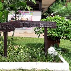
Plan for wet conditions year-round, though some months are drier than others for traveling. The territory is spread across 34 separate barangays, so knowing which area you want to visit ahead of time helps with navigation.
The name comes from Datu Udtog Matalam and translates to weaponry or arms in the Maguindanaon language. This linguistic connection reflects the historical importance of the former leader who shaped the region.
Location: Cotabato
Elevation above the sea: 42 m
Shares border with: Carmen, M'lang, Antipas, Kabacan, Kidapawan, President Roxas
Address: 6W5H+GC5, Matalam, Cotabato, Philippines
Website: http://matalam-cotabatoprov.gov.ph
GPS coordinates: 7.08333,124.90000
Latest update: December 12, 2025 08:00
Mount Apo
42.4 km
Musuan Peak
90.3 km
Bangsamoro Parliament
73.3 km
Mount Ragang
80.7 km
San Pedro Cathedral
78.4 km
Fort Pikit
24.6 km
Epol Falls
55.6 km
Davao River Bridge
76.7 km
Tantawan Park
73.9 km
RR Family Spring Resort
84.4 km
Mount Apo Natural Park
45.6 km
D' Bone Collector Museum
78.8 km
Museo Dabawenyo
76.7 km
Fuerte de Reina Regente
43.4 km
Sultan Dipatuan Kudarat historical marker
73.9 km
Davao City Hall historical marker
78.2 km
Andres Bonifacio historical marker
66.4 km
Pasol Mo
63.7 km
Ohta Kyozaburo historical marker
66.3 km
Notre Dame Archdiocesan Seminary historical marker
71.4 km
MGG Resort
80.4 km
Museyo Kutawato
8.2 km
Port Sta. Ana historical marker
80.2 km
Ruihak Event Venue & Resort
84.9 km
Datu Paglas Municipal Hall
37.7 km
Balnunto Falls
58.4 km
Carmen Public Market
17.8 km
Binaan falls
80.6 kmVisited this place? Tap the stars to rate it and share your experience / photos with the community! Try now! You can cancel it anytime.
Discover hidden gems everywhere you go!
From secret cafés to breathtaking viewpoints, skip the crowded tourist spots and find places that match your style. Our app makes it easy with voice search, smart filtering, route optimization, and insider tips from travelers worldwide. Download now for the complete mobile experience.
A unique approach to discovering new places❞
— Le Figaro
All the places worth exploring❞
— France Info
A tailor-made excursion in just a few clicks❞
— 20 Minutes