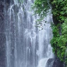
Pagadian, Component city in Zamboanga del Sur, Philippines
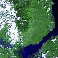
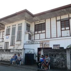
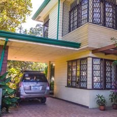
Pagadian is a settlement in Zamboanga del Sur on Mindanao that spreads across hilly terrain ranging from sea level to high elevations. The place covers a large area and includes different altitude zones with residential neighborhoods, shops and public buildings along the slopes.
The place developed from a trading post that connected Zamboanga with northern settlements and received municipality status in 1937. Three decades later, in 1969, it was elevated to city status, reflecting its growing importance for the region.
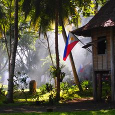
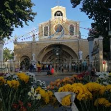
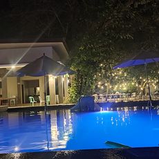
Residents call the place "City of Smiles", a name that reflects the friendliness visitors often notice when walking through markets and neighborhoods. Local festivals throughout the year bring people from different backgrounds together for public celebrations that fill streets and plazas with music and food stalls.
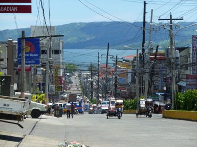
The settlement is divided into 54 administrative districts called barangays scattered across the entire area. Visitors should expect steep roads and can use local tricycles adapted for this terrain.
Tricycles drive up and down the roads here at unusual angles, an adaptation rarely seen elsewhere. This tilted driving has become the normal way to move around town, and drivers handle the slopes effortlessly.
Location: Zamboanga del Sur
Inception: March 23, 1937
Elevation above the sea: 187 m
Shares border with: Midsalip, Lakewood, Tigbao, Dumalinao, Labangan
Website: http://pagadian.gov.ph
GPS coordinates: 7.82722,123.43639
Latest update: December 5, 2025 16:33
Maria Cristina Falls
92.5 km
Tinago Falls
90.5 km
Mount Malindang
48.7 km
Jose Rizal Memorial Protected Landscape
93.5 km
Jimenez Church
71.8 km
Our Lady of the Most Holy Rosary Cathedral
85.1 km
Baliangao Protected Landscape and Seascape
91 km
Casa Bernedo
85.4 km
Fort of the Conception and Triumph
57.1 km
Alindahaw Lakeview Resort
28 km
Pagadian Cathedral
354 m
Donel's Beach Resort
12.1 km
Casa Real historical marker
92.2 km
Saint James the Greater Parish Church
92.1 km
Site where Rizal Landed historical marker
92.3 km
The Visit of Valenzuela in Dapitan historical marker
93.5 km
Dr. Jose Rizal Memorial Hospital historical marker
90.4 km
Dapitan Park historical marker
92.2 km
José Rizal at Dapitan Church historical marker
92.1 km
The Old Town of Dapitan historical marker
91.3 km
Farm of Jose Rizal historical marker
76.6 km
Macapagal-Macaraeg Ancestral House historical marker
91.3 km
Dapitan Park
92.2 km
Macapagal-Macaraeg House
91.3 km
Fort of the Conception and Triumph historical marker
57.1 km
Jose F. Ozamiz historical marker
78.1 km
Del Monte Public Swimming Pool
49.8 km
Dr. Jose Rizal historical marker
93.5 kmVisited this place? Tap the stars to rate it and share your experience / photos with the community! Try now! You can cancel it anytime.
Discover hidden gems everywhere you go!
From secret cafés to breathtaking viewpoints, skip the crowded tourist spots and find places that match your style. Our app makes it easy with voice search, smart filtering, route optimization, and insider tips from travelers worldwide. Download now for the complete mobile experience.
A unique approach to discovering new places❞
— Le Figaro
All the places worth exploring❞
— France Info
A tailor-made excursion in just a few clicks❞
— 20 Minutes