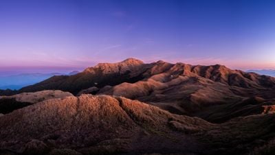
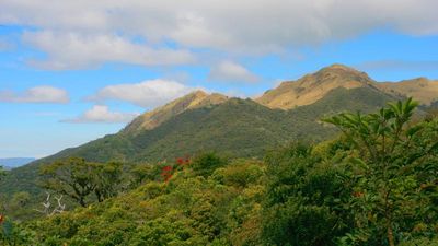
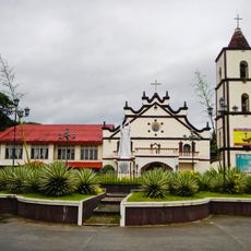
Mount Pulag, Mountain summit in Cordillera Administrative Region, Philippines
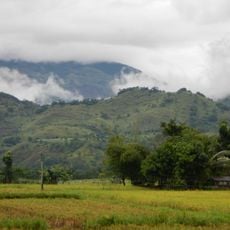
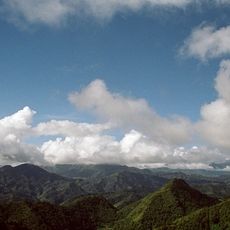
Mount Pulag reaches 2,922 meters (9,587 feet) and sits within a national park where the landscape shifts between grasslands, mossy forest and pine stands. Vegetation changes with elevation, so hikers pass through several climate zones before reaching the open summit area.
The Philippine government created the national park in 1987 to protect over 11,500 hectares of mountain ecosystems. This move also secured the indigenous territories of Cordillera peoples who have inhabited and used the summit for generations.
The Ibaloi, an indigenous people of the Cordillera, consider this mountain a sacred place and traditional home of ancestral spirits. Visitors sometimes meet local guides who share stories about old rituals and spiritual practices that continue in ceremonies today.
Hikers must obtain a permit from the park office and stay on marked routes such as Ambangeg for beginners or Akiki for experienced climbers. Warm clothing is necessary because temperatures drop sharply at the summit, especially during early morning hours and cooler months.
Frost forms regularly on the summit during winter months, a rare phenomenon in the Philippines where temperatures fall below zero degrees Celsius. These icy conditions create an unusual landscape with frost covering grasses and rocks, surprising visitors from warmer regions of the country.
Location: Cordillera Administrative Region
Location: Cagayan Valley
Inception: 1987
Elevation above the sea: 2,922 m
GPS coordinates: 16.59773,120.89879
Latest update: December 12, 2025 18:02
The Philippines is an archipelago where nature shows off in every direction. Each island has its own character. You can find white sandy beaches that stretch for kilometers, coral reefs teeming with colorful fish, and lagoons where the water is so transparent you can see straight to the bottom. The...
Laperal White House
37.6 km
Baguio Botanical Garden
36.7 km
The Mansion
36.1 km
Baguio Cathedral
38.1 km
Mines View Park
35.1 km
Camp John Hay
38 km
Valley of Colors
36.9 km
Bayombong Cathedral
29.7 km
Salinas Natural Monument
28.3 km
Saint Catherine of Siena Parish Church
32.3 km
Mount Pulag National Park
10.7 km
Baguio Teachers’ Camp historical marker
37.2 km
Bell Church
37 km
New Highest Point
11.7 km
Mansion House historical marker
36.1 km
Baguio Country Club historical marker
36.7 km
Bayombong Municipal Hall
29.8 km
Emilio F. Aguinaldo Museum
37.9 km
Surrender of General Yamashita historical marker
28.2 km
Former Site of Philippine Military Academy historical marker
37.1 km
Jss Thermal Pool
35.6 km
Camp of the Teachers historical marker
37 km
Mansion House historical marker
36.1 km
Brent School historical marker
37.5 km
Lucky Five Swimming Pool
35.6 km
United States Embassy Residence Baguio historical marker
37.6 km
Aldom's Resort
35.6 km
Aular Pool
34.3 kmVisited this place? Tap the stars to rate it and share your experience / photos with the community! Try now! You can cancel it anytime.
Discover hidden gems everywhere you go!
From secret cafés to breathtaking viewpoints, skip the crowded tourist spots and find places that match your style. Our app makes it easy with voice search, smart filtering, route optimization, and insider tips from travelers worldwide. Download now for the complete mobile experience.
A unique approach to discovering new places❞
— Le Figaro
All the places worth exploring❞
— France Info
A tailor-made excursion in just a few clicks❞
— 20 Minutes