Enable Location

We need your location to show you interesting places around you

Discover nearby places

Find interesting locations and hidden gems around you

Precise directions

Get accurate directions and distances to places

Your location is never shared with other users. It's only used when you tap the location button.

Distaghil Sar

Log in to your account

Start exploring — it's free

Trusted by 61,366 travelers worldwide

Continue with Google
Continue with Apple
or

We will send you a code to connect

By continuing, you accept our Terms and Conditions and our Privacy Policy

Check your inbox

We've sent a pincode in your inbox. Please enter the code below.

Distaghil Sar

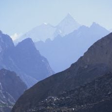
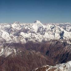
Distaghil Sar, Mountain summit in Gilgit-Baltistan, Pakistan.

Description

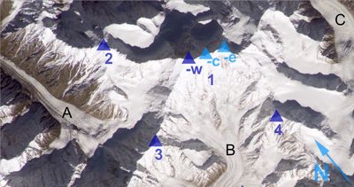
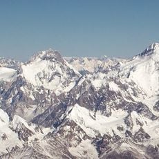
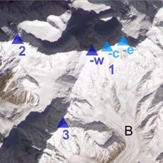
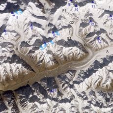
Distaghil Sar is a mountain in the Karakoram range that rises to 7,885 meters and forms a long summit ridge. Three distinct peaks of different heights sit along this approximately 3-kilometer crest, creating a complex summit structure.

History

The first successful ascent took place in 1960 when Austrian climbers reached the summit via the southwest ridge. Since then, climbing has remained rare due to the mountain's extreme altitude and remote location.

Culture

The name comes from the Wakhi language of Shimshal Valley inhabitants and means 'above the inner ranch' in their traditional speech. The mountain holds meaning for local communities as part of their ancestral territory and way of understanding their high-altitude world.

Practical

Climbing this mountain demands advanced mountaineering skills and experience with extreme altitude, as conditions are very demanding. The best window is during warmer months when weather patterns become more stable and access is feasible.

Did you know?

The main ridge spans about 3 kilometers while staying above 7,400 meters and connects three peaks of varying heights. This makes the mountain unusually challenging since climbers must navigate multiple high summits rather than ascending to a single peak.

Location
Elevation above the sea
7,885 m
GPS coordinates
36.32474,75.18840
Latest update
December 10, 2025 16:00

AroundUs brings together thousands of curated places, local tips, and hidden gems, enriched daily by 60,000 contributors worldwide. Discover all places nearby (Gilgit-Baltistan).

« Distaghil Sar - Mountain summit in Gilgit-Baltistan, Pakistan » is provided by Around Us (aroundus.com). Images and texts are derived from Wikimedia project under a Creative Commons license. You are allowed to copy, distribute, and modify copies of this page, under the conditions set by the license, as long as this note is clearly visible.

Discover hidden gems everywhere you go!

From secret cafés to breathtaking viewpoints, skip the crowded tourist spots and find places that match your style. Our app makes it easy with voice search, smart filtering, route optimization, and insider tips from travelers worldwide. Download now for the complete mobile experience.

Around Us App Screenshot

A unique approach to discovering new places

Le Figaro

All the places worth exploring

France Info

A tailor-made excursion in just a few clicks

20 Minutes

Around Us
Travel Guide & Maps
Download

Send to your phone

QR Code
1

Open the camera app on your mobile.

2

Point at the QR code with your camera. A notification will appear.

3

Tap the notification to open the link.