·

Enable Location

We need your location to show you interesting places around you

Discover nearby places

Find interesting locations and hidden gems around you

Precise directions

Get accurate directions and distances to places

Your location is never shared with other users. It's only used when you tap the location button.

Babia Góra

Log in to your account

Start exploring — it's free

Trusted by 62,647 travelers worldwide

Continue with Google
Continue with Apple
or

We will send you a code to connect

By continuing, you accept our Terms and Conditions and our Privacy Policy

Check your inbox

We've sent a pincode in your inbox. Please enter the code below.

Babia Góra

Babia Góra, Mountain summit in Western Carpathians, Slovakia.

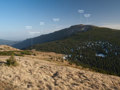
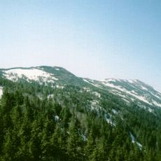
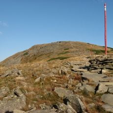
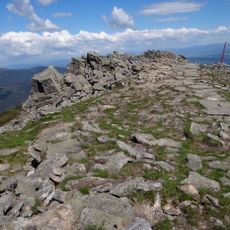
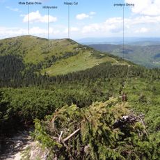
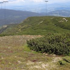
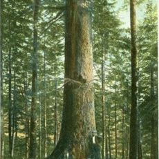
Babia Góra reaches 1,725 meters (5,659 feet) and sits on the border between Poland and Slovakia in the Western Carpathians. The flanks alternate between rocky sections and forested slopes that climb up to the treeline.

The first documented ascent occurred in the 18th century by a naturalist from Vienna. Border changes after both world wars shifted the summit several times between different administrations.

The name may derive from old Slavic words referring to witches who gathered here according to folk tales passed down by shepherds. Hikers still find wooden figures and small chapels along the trails, placed by herders centuries ago.

Most routes begin from villages on the Polish side, with the ascent taking several hours and including steep passages. Weather changes occur quickly, so bringing extra clothing and sufficient water is advisable.

On some days fog drifts so low over the slopes that hikers can see only a few meters ahead. The wind shapes trees near the treeline into bent forms that all point in the same direction.

The community of curious travelers

AroundUs brings together thousands of curated places, local tips, and hidden gems, enriched daily by 60,000 contributors worldwide.

Start exploring
Location
Elevation above the sea
1,725 m
Address
Diablak, Poland
GPS coordinates
49.57302,19.52933
Latest update
January 25, 2026 03:11
Little Poland and the Carpathians: medieval castles, salt mines and historic towns

The south of Poland stretches between Krakow and the Carpathians. There are medieval castles on cliffs, salt mines that became real underground towns since the 13th century, and wooden churches protected by UNESCO. The national parks have trails through gorges and beech forests. The thermal baths...

« Babia Góra - Mountain summit in Western Carpathians, Slovakia » is provided by Around Us (aroundus.com). Images and texts are derived from Wikimedia project under a Creative Commons license. You are allowed to copy, distribute, and modify copies of this page, under the conditions set by the license, as long as this note is clearly visible.

Discover hidden gems everywhere you go!

From secret cafés to breathtaking viewpoints, skip the crowded tourist spots and find places that match your style. Our app makes it easy with voice search, smart filtering, route optimization, and insider tips from travelers worldwide. Download now for the complete mobile experience.

Around Us App Screenshot

A unique approach to discovering new places

Le Figaro

All the places worth exploring

France Info

A tailor-made excursion in just a few clicks

20 Minutes

Around Us
Travel Guide & Maps
Download

Send to your phone

QR Code
1

Open the camera app on your mobile.

2

Point at the QR code with your camera. A notification will appear.

3

Tap the notification to open the link.