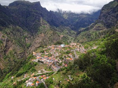
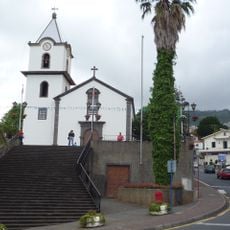
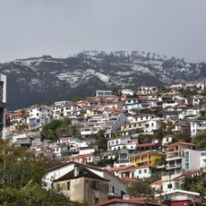
Curral das Freiras, Civil parish in Câmara de Lobos, Madeira, Portugal
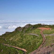
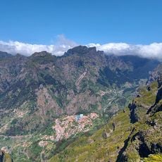
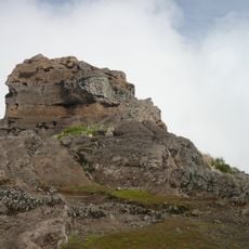
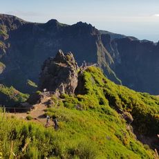
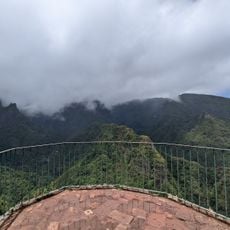
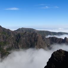
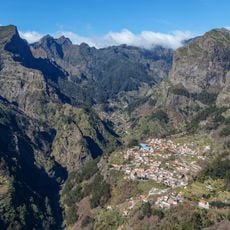
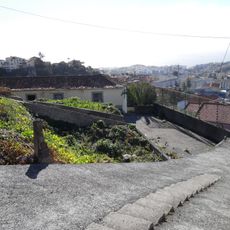
Curral das Freiras occupies a deep mountain valley surrounded by steep cliffs that rise over 3,280 feet (1,000 meters), creating a naturally protected settlement in the central region of Madeira.
In 1566, nuns from the Convent of Santa Clara sought refuge in this remote valley to escape pirate attacks on Funchal, bringing their convent treasures and giving the village its name, which means Pen of the Nuns.
The annual Chestnut Festival celebrates the locally grown chestnuts with traditional sweets, music, and regional crafts, while the Ginja Cherry Festival honors another important crop through community celebrations and culinary demonstrations.
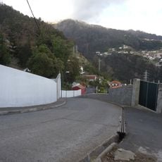
A single tunnel road built in 2004 provides the main access route from Funchal, connecting this formerly isolated community with the capital and improving transportation for residents and visitors.
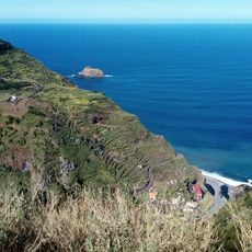
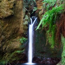
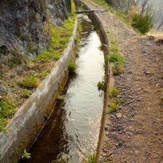
The valley's terraced hillsides support cultivation of sweet cherries and chestnuts at elevations near 1,500 feet (457 meters), producing regional specialties that have sustained the local agricultural economy for centuries.
Location: Câmara de Lobos
Website: https://jf-curraldasfreiras.pt
GPS coordinates: 32.72083,-16.96583
Latest update: November 28, 2025 15:21
This collection covers the main natural areas and cultural sites across Madeira, a Portuguese island of volcanic origin in the Atlantic Ocean. The route connects coastal regions with highland areas, showcasing the diverse vegetation that results from the subtropical climate and varied elevation levels. Included locations feature Pico Ruivo, the island's highest peak at 1,861 meters, the sea cliffs at Cabo Girão, the botanical gardens of Funchal with plant collections from multiple continents, and several coastal and mountain viewpoints. The route also incorporates examples of traditional levada irrigation channels, which have distributed water across the island for centuries.
Pico Ruivo
4.8 km
Pico do Arieiro
3.8 km
Achada do Teixeira
6.5 km
Madeira Natural Park
2.3 km
Pico das Torres
4.2 km
Levada do Furado
7.8 km
Laurisilva of Madeira
6 km
Igreja de Nossa Senhora da Graça
5.7 km
Miradouro do Paredão
1.2 km
Pico Grande
2.8 km
"Bussardnest"
3.7 km
Estação de Radar N.º 4
3.9 km
Boca dos Namorados
3 km
Levada do Curral e Castelejo
2.5 km
Espigão
6.3 km
Quinta do Jamboto
5.9 km
Miradouro dos Balcões
7.4 km
Pico Ruivo
4.8 km
Caldeirão do Inferno
5.3 km
Capela de Nossa Senhora da Alegria
6.3 km
Poço da Neve
3.9 km
Igreja de Nossa Senhora do Livramento
63 m
Miradouro da Eira do Serrado
1.2 km
Levadas of Madeira Island
1.3 km
Poço Dos Chefes
465 m
Casa de Abrigo do Pico Ruivo
5 km
Beco da Jacinta
6.3 km
Pico das Pedras
4.5 kmReviews
Visited this place? Tap the stars to rate it and share your experience / photos with the community! Try now! You can cancel it anytime.
Discover hidden gems everywhere you go!
From secret cafés to breathtaking viewpoints, skip the crowded tourist spots and find places that match your style. Our app makes it easy with voice search, smart filtering, route optimization, and insider tips from travelers worldwide. Download now for the complete mobile experience.
A unique approach to discovering new places❞
— Le Figaro
All the places worth exploring❞
— France Info
A tailor-made excursion in just a few clicks❞
— 20 Minutes