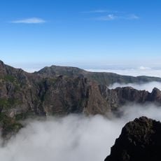
Pico do Arieiro, Mountain summit in Madeira, Portugal
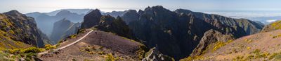
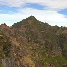
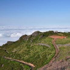
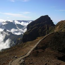
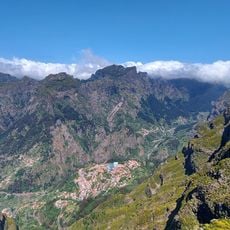
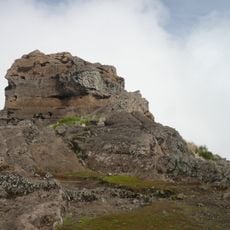
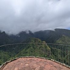
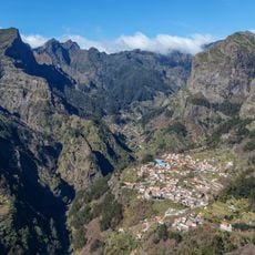
Pico do Arieiro is a mountain summit on Madeira rising to approximately 1,818 meters. The landscape features steep rocky cliffs, jagged rock formations, and shifting cloud layers that frequently roll across and past the peak.
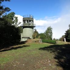
In the 15th century, Portuguese explorers used this high point to keep watch over sea routes surrounding Madeira. The mountain served as a strategic lookout for monitoring ships and detecting threats approaching the island.
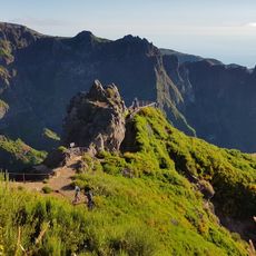
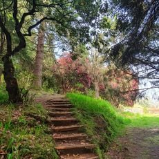
The name reflects the mountain's prominence in Madeiran geography and local identity. Hikers and nature enthusiasts gather here regularly, making it a meeting point for those drawn to the island's high places.
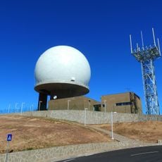
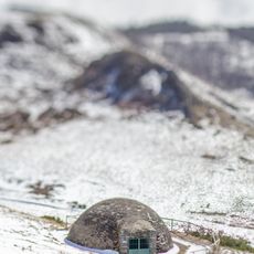
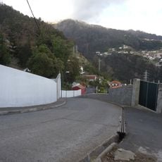
You can reach the peak year-round via a paved road from Funchal, with parking available near the summit. Once there, you will find a visitor center, restrooms, and shelters to protect from wind and sudden weather changes.
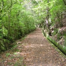
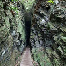
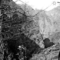
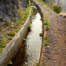
The PR1 hiking trail connects this summit to Pico Ruivo and passes through tunnels carved directly into volcanic rock. These underground sections offer an unusual experience, as hikers walk through the mountain itself rather than around it.
Location: Madeira
Elevation above the sea: 1,818 m
GPS coordinates: 32.73557,-16.92865
Latest update: December 6, 2025 16:02
Cliffs rank among Earth's most striking geological formations, ranging from coastal precipices to inland mountain faces. Along oceans, they shape coastlines for thousands of miles, while in mountain regions they form vertical walls that draw climbers from around the world. This collection documents...
From the highest peaks to coastal cliffs, this collection brings together geographically significant observation points across all continents. The locations offer views of mountain ranges, waterfalls, deserts, oceans, and notable architectural structures. The selection includes the Great Wall near...
Pico Ruivo
2.9 km
Quinta do Monte
7 km
Achada do Teixeira
3.4 km
Madeira Natural Park
2.4 km
Pico das Torres
1.6 km
Terreiro da Luta
6.4 km
Levada do Furado
4.1 km
Miradouro do Paredão
3.1 km
Pico Grande
5.5 km
"Bussardnest"
613 m
Estação de Radar N.º 4
26 m
Pico do Suna
7 km
Balcões
3.7 km
Santuário da Nossa Senhora da Paz
6.3 km
Boca dos Namorados
6.4 km
Levada do Curral e Castelejo
5.2 km
Pico das Pedras
5.6 km
Pico Ruivo
2.9 km
Caldeirão do Inferno
3.9 km
Monumento a Nossa Senhora da Paz
6.3 km
Poço da Neve
1.2 km
Igreja de Nossa Senhora do Livramento
3.9 km
Miradouro da Eira do Serrado
4.5 km
Capela de Nossa Senhora da Alegria
6.3 km
Levadas of Madeira Island
3 km
Poço Dos Chefes
4.3 km
Casa de Abrigo do Pico Ruivo
3 km
Fonte de Nossa Senhora do Monte
7 kmVisited this place? Tap the stars to rate it and share your experience / photos with the community! Try now! You can cancel it anytime.
Discover hidden gems everywhere you go!
From secret cafés to breathtaking viewpoints, skip the crowded tourist spots and find places that match your style. Our app makes it easy with voice search, smart filtering, route optimization, and insider tips from travelers worldwide. Download now for the complete mobile experience.
A unique approach to discovering new places❞
— Le Figaro
All the places worth exploring❞
— France Info
A tailor-made excursion in just a few clicks❞
— 20 Minutes