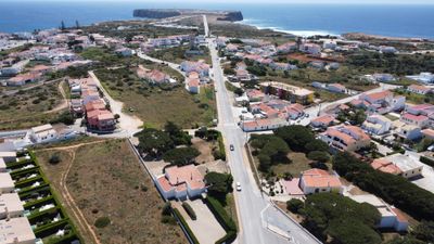
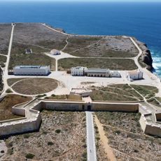
Sagres, Coastal parish in Vila do Bispo, Portugal
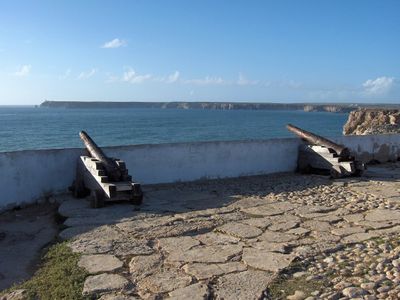
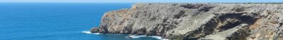
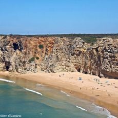
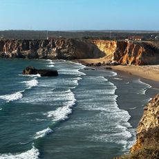
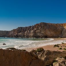
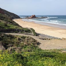
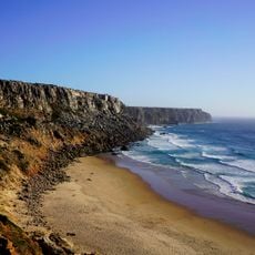
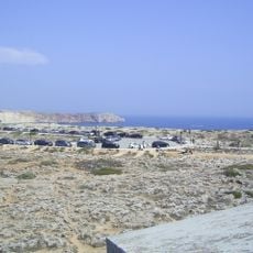
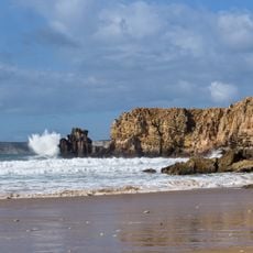
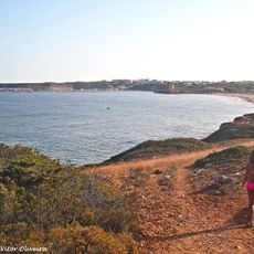
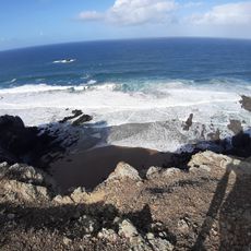
Sagres is a coastal settlement at the southwestern tip of continental Europe, where dramatic cliffs rise between 50 and 200 meters above the Atlantic Ocean. The fortress and surrounding areas form a rugged landscape shaped by wind and ocean forces.
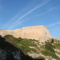
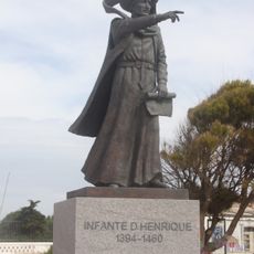
Prince Henry the Navigator controlled his maritime endeavors from this region until his death in 1460, when Portuguese explorers had reached Sierra Leone. The fortress became a center for Portuguese exploration activities that would transform global navigation.
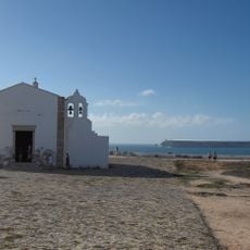
The Church of Santa Maria within Sagres Fortress features a notable gilded altarpiece from the Chapel of Santo António. The site continues to shape religious life in the community and draws those interested in exploring sacred architecture.
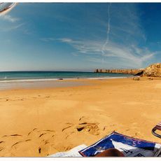
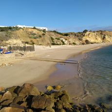
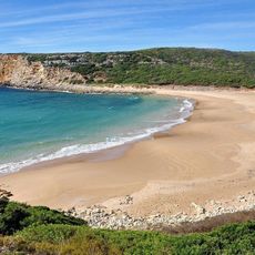
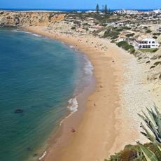
The area has multiple beaches suitable for water sports, with consistent conditions year-round for activities like surfing. Visitors should prepare for changeable weather and strong winds that can affect their time here.
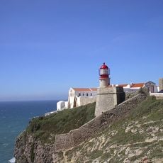
The name comes from the Latin term Sagrado, meaning sacred, as ancient Mediterranean cultures viewed this place as a meeting point for their gods. This spiritual connection has shaped the character of the location for centuries.
Location: Vila do Bispo
Inception: 1519
Address: 8650 Sagres, Portugal
Website: http://sagresonline.com
GPS coordinates: 37.00783,-8.94192
Latest update: December 20, 2025 11:31
Fortaleza de Sagres
966 m
E9 European long distance path
5 km
Cabo de São Vicente Lighthouse
5.1 km
Praia do Beliche
2.8 km
Praia do Tonel
581 m
Fort of Santo António de Belixe
4.2 km
Fortaleza de São Vicente
5.1 km
Praia do Martinhal
1.8 km
Igreja de Nossa Senhora da Graça (Sagres)
947 m
Forte de Nossa Senhora da Guia
1.4 km
Pousada de São Vicente
729 m
Praia do Tonel
583 m
Praia da Ponta Ruiva
7.1 km
Praia do Telheiro
5.3 kmCrómlech de Amantes 1
7 km
Conjunto de menires de Vila do Bispo (Pedra Escorregadia; Casa do Francês; Amantes I; Amantes II; Cerro do Camacho)
6.5 kmCrómlech de Amantes 2
7 kmPosto da Guarda Fiscal, GF, de Sagres
47 m
Hotel da Baleeira
947 m
Menires do Cerro do Camacho
6.6 km
Estátua do Infante D. Henrique
121 m
Ponta de Sagres e Cabo de São Vicente
3.5 km
Praia da Baleeira (lapyahan, lat 37,01, long -8,93)
1.1 km
Praia do Barranco
6 km
Praia da Mareta
343 m
Praia do Tonel (lapyahan sa Distrito de Faro)
615 m
Praia dos Rebolinhos
2.5 km
Praia das Eiras
6.3 kmVisited this place? Tap the stars to rate it and share your experience / photos with the community! Try now! You can cancel it anytime.
Discover hidden gems everywhere you go!
From secret cafés to breathtaking viewpoints, skip the crowded tourist spots and find places that match your style. Our app makes it easy with voice search, smart filtering, route optimization, and insider tips from travelers worldwide. Download now for the complete mobile experience.
A unique approach to discovering new places❞
— Le Figaro
All the places worth exploring❞
— France Info
A tailor-made excursion in just a few clicks❞
— 20 Minutes