Enable Location

We need your location to show you interesting places around you

Discover nearby places

Find interesting locations and hidden gems around you

Precise directions

Get accurate directions and distances to places

Your location is never shared with other users. It's only used when you tap the location button.

Chita

Log in to your account

Start exploring — it's free

Trusted by 62,377 travelers worldwide

Continue with Google
Continue with Apple
or

We will send you a code to connect

By continuing, you accept our Terms and Conditions and our Privacy Policy

Check your inbox

We've sent a pincode in your inbox. Please enter the code below.

Chita

Chita, Administrative center in Zabaykalsky Krai, Russia

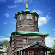
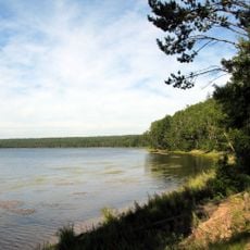
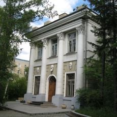
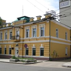
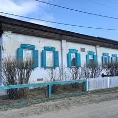
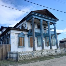
Chita is the administrative center of Zabaykalsky Krai, positioned where the Chita and Ingoda rivers meet amid the Yablonoi Mountains and the Chersky Range at an elevation of roughly 650 meters (2,130 feet). Wide avenues and Soviet-era residential blocks define much of the layout, interspersed with timber houses from earlier centuries and public squares marked by monuments.

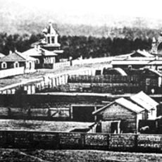
The settlement began in the 17th century as a Cossack outpost and grew after exiled Decembrists arrived in 1827, bringing education and intellectual life to the region. Connection to the Trans-Siberian Railway in the late 19th century permanently linked the town to western Russia and the Pacific coast.

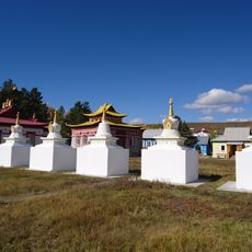
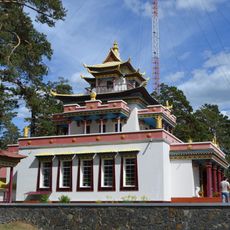
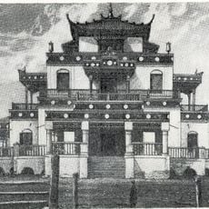
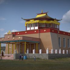
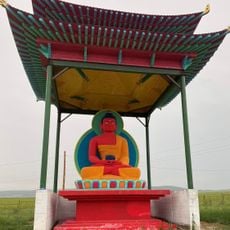
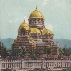
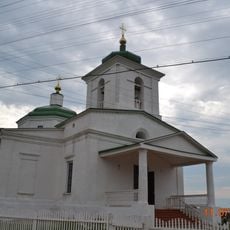
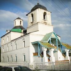
Theaters and concert halls feature performances that draw from both Russian and Buryat traditions, reflecting influences from neighboring communities. Residents observe both Orthodox holidays and Buddhist celebrations, creating overlapping religious calendars that shape the rhythm of public life and seasonal gatherings.

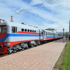
A main railway station on the Trans-Siberian line links the town to destinations east and west across Russia, while an airport roughly 15 kilometers (9 miles) from the center serves regional and national routes. Visitor facilities and lodging concentrate near central streets, where public transport connects residential districts with key points around the town.

Large workshops and repair facilities along the rail line service and overhaul locomotives traveling between Europe and the Pacific. This work keeps the longest continuous railway route in the world operational, maintaining infrastructure that remains essential for both freight and passenger movement across continents.

The community of curious travelers

AroundUs brings together thousands of curated places, local tips, and hidden gems, enriched daily by 60,000 contributors worldwide.

Start exploring
Location
Chita Urban Okrug
Inception
1653
Elevation above the sea
650 m
GPS coordinates
52.03341,113.50089
Latest update
December 12, 2025 19:43
Around this place
Daursky Nature Reserve
Russian Federation

Daursky Nature Reserve

281.2 km
Alkhanay National Park
Russian Federation

Alkhanay National Park

133.7 km
Aginsky Datsan
Russian Federation

Aginsky Datsan

125.2 km
Russian Federation

Multilayer settlement "Sunny Mys"

277.3 km
Decabrists Church, Chita
Russian Federation

Decabrists Church, Chita

1.6 km
Russian Federation

Tsugolskij Datsan

183.7 km
Chitinsky Datsan
Russian Federation

Chitinsky Datsan

2.3 km
Lake Arey
Russian Federation

Lake Arey

194.7 km
Malaya Zabaykalskaya railway
Russian Federation

Malaya Zabaykalskaya railway

2.9 km
Aninsky datsan
Russian Federation

Aninsky datsan

252.4 km
Egituysky datsan
Russian Federation

Egituysky datsan

194.8 km
Zabaykalskiy Krayevoy Dramaticheskiy Teatr
Russian Federation

Zabaykalskiy Krayevoy Dramaticheskiy Teatr

388 m
Lokomotiv Stadium
Russian Federation

Lokomotiv Stadium

2.1 km
Transbaikalian historical museum in Chita
Russian Federation

Transbaikalian historical museum in Chita

560 m
Chita Zoo
Russian Federation

Chita Zoo

958 m
Джарун Хашор
Russian Federation

Джарун Хашор

250.7 km
Torey Lakes
Mongolia

Torey Lakes

263.4 km
Кіжингинський дацан
Russian Federation

Кіжингинський дацан

257.1 km
Alexander Nevsky Cathedral
Russian Federation

Alexander Nevsky Cathedral

12 m
Selitryanoye Lake
Russian Federation

Selitryanoye Lake

124.7 km
Дом Лопатиной-Гантимуровой
Russian Federation

Дом Лопатиной-Гантимуровой

341 m
Shaman-Gora
Russian Federation

Shaman-Gora

220.9 km
Landscapes of Dauria
Mongolia

Landscapes of Dauria

270.2 km
Покровский монастырь (Чита)
Russian Federation

Покровский монастырь (Чита)

1.5 km
Спасо-Преображенская церковь (Баргузин)
Russian Federation

Спасо-Преображенская церковь (Баргузин)

313.5 km
Nativity of Christ Church
Russian Federation

Nativity of Christ Church

299.3 km
Дом Бутлицкого (Баргузин)
Russian Federation

Дом Бутлицкого (Баргузин)

313.7 km
Здание банка (Баргузин)
Russian Federation

Здание банка (Баргузин)

313.7 km
Show the full map
« Chita - Administrative center in Zabaykalsky Krai, Russia » is provided by Around Us (aroundus.com). Images and texts are derived from Wikimedia project under a Creative Commons license. You are allowed to copy, distribute, and modify copies of this page, under the conditions set by the license, as long as this note is clearly visible.

Discover hidden gems everywhere you go!

From secret cafés to breathtaking viewpoints, skip the crowded tourist spots and find places that match your style. Our app makes it easy with voice search, smart filtering, route optimization, and insider tips from travelers worldwide. Download now for the complete mobile experience.

Around Us App Screenshot

A unique approach to discovering new places

Le Figaro

All the places worth exploring

France Info

A tailor-made excursion in just a few clicks

20 Minutes

Around Us
Travel Guide & Maps
Download

Send to your phone

QR Code
1

Open the camera app on your mobile.

2

Point at the QR code with your camera. A notification will appear.

3

Tap the notification to open the link.