Chest opened
+${chestReward.xp} XP
Explorer
NOUVEAU ×${chestReward.collectible.quantity}
tapez pour fermer
Chest locked

Open chests in the app

Around Us is built for your phone — chests unlock when you walk, explore and capture nearby places.

Enable Location

We need your location to show you interesting places around you

Discover nearby places

Find interesting locations and hidden gems around you

Precise directions

Get accurate directions and distances to places

Your location is never shared with other users. It's only used when you tap the location button.

Yugorsk

Log in to your account

Start exploring — it's free

Trusted by 72,889 travelers worldwide

Continue with Google
Continue with Apple
or

We will send you a code to connect

By continuing, you accept our Terms and Conditions and our Privacy Policy

Check your inbox

We've sent a pincode in your inbox. Please enter the code below.

Discussion Reviews 1 Photos
51.7k Popularity

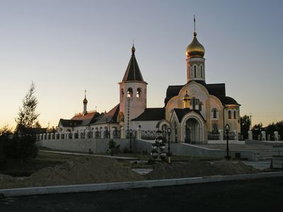
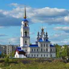
Yugorsk, Industrial town in Khanty-Mansi Autonomous Okrug, Russia

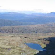
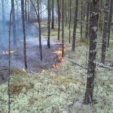
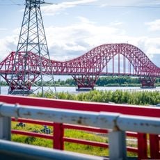
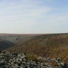
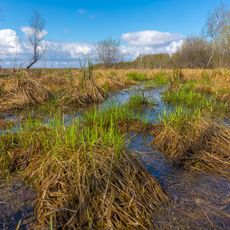
Yugorsk is an industrial city in the Khanty-Mansi region situated within a forest and peatland landscape. The settlement developed as a center for natural gas extraction and remains surrounded by extensive wetlands and taiga forest.

The settlement was founded in 1962 as Komsomolsky to support timber and natural gas industries. It received its current name in 1992 and has remained tied to resource extraction ever since.

The city sits on traditional lands of the Khanty and Mansi peoples, whose presence shaped the surrounding landscape. Today, visitors can sense this connection through the natural environment and local communities.

The city is accessible year-round, though winters are long and cold with heavy snowfall. Visitors should prepare for extreme weather conditions and expect limited tourist infrastructure.

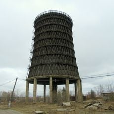
The city hosts advanced gas processing facilities that employ technology from multiple nations. For those interested, it offers a rare chance to understand the mechanics of Western Siberia's energy industry firsthand.

The community of curious travelers

AroundUs brings together thousands of curated places, local tips, and hidden gems, enriched daily by 60,000 contributors worldwide.

Start exploring
Inception
1962
Elevation above the sea
110 m
GPS coordinates
61.31667,63.35000
Latest update
December 14, 2025 18:14
Around this place
Manpupuner rock formations
Russian Federation

Manpupuner rock formations

237.5 km
North Urals
Russian Federation

North Urals

219.7 km
Otorten
Russian Federation

Otorten

220 km
Yugyd Va National Park
Russian Federation

Yugyd Va National Park

413.4 km
Zapovednik Denezhkin Kamen
Russian Federation

Zapovednik Denezhkin Kamen

229.7 km
Vishera Nature Reserve
Russian Federation

Vishera Nature Reserve

221 km
Archeopark
Russian Federation

Archeopark

306.1 km
Little Sosva Nature Reserve
Russian Federation

Little Sosva Nature Reserve

94 km
Drago rosso
Russian Federation

Drago rosso

304.6 km
Kvarkush
Russian Federation

Kvarkush

280.4 km
Wooden cooling tower
Russian Federation

Wooden cooling tower

223.9 km
Zhigalan Waterfalls
Russian Federation

Zhigalan Waterfalls

281.9 km
Presentation Cathedral in Karpinsk
Russian Federation

Presentation Cathedral in Karpinsk

252.5 km
Saints Peter and Paul
Russian Federation

Saints Peter and Paul

226.8 km
Evgraf Fedorov Geological Museum
Russian Federation

Evgraf Fedorov Geological Museum

243.4 km
Lake Svetloye
Russian Federation

Lake Svetloye

201.8 km
Transfiguration church in Serov
Russian Federation

Transfiguration church in Serov

244.1 km
Varysh Rock on the Beryozovaya River
Russian Federation

Varysh Rock on the Beryozovaya River

296.5 km
The Church of the Vernicle Image of the Saviour, Krasnogorskoye
Russian Federation

The Church of the Vernicle Image of the Saviour, Krasnogorskoye

305 km
Puramunitur
Russian Federation

Puramunitur

215.6 km
Часовня Александра Невского (Краснотурьинск)
Russian Federation

Часовня Александра Невского (Краснотурьинск)

243.2 km
Церковь Рождества Богородицы (фундамент)
Russian Federation

Церковь Рождества Богородицы (фундамент)

241.6 km
Евангелическо-лютеранская церковь (Краснотурьинск)
Russian Federation

Евангелическо-лютеранская церковь (Краснотурьинск)

244.8 km
Здание пожарного депо (Ханты-Мансийск)
Russian Federation

Здание пожарного депо (Ханты-Мансийск)

306 km
Церковь Рождества Пресвятой Богородицы (каменная) (Берёзово)
Russian Federation

Церковь Рождества Пресвятой Богородицы (каменная) (Берёзово)

304.5 km
Спасская церковь (Шеркалы)
Russian Federation

Спасская церковь (Шеркалы)

194.6 km
Yelizarovsky Zakaznik
Russian Federation

Yelizarovsky Zakaznik

245.8 km
Church of the Nativity of the Blessed Virgin
Russian Federation

Church of the Nativity of the Blessed Virgin

304.5 km
Show the full map
Reviews
Share your experience

No review yet

Discussions
Start a discussion...

No discussion yet

« Yugorsk - Industrial town in Khanty-Mansi Autonomous Okrug, Russia » is provided by Around Us (aroundus.com). Images and texts are derived from Wikimedia project under a Creative Commons license. You are allowed to copy, distribute, and modify copies of this page, under the conditions set by the license, as long as this note is clearly visible.

Discover hidden gems everywhere you go!

From secret cafés to breathtaking viewpoints, skip the crowded tourist spots and find places that match your style. Our app makes it easy with voice search, smart filtering, route optimization, and insider tips from travelers worldwide. Download now for the complete mobile experience.

Around Us App Screenshot

A unique approach to discovering new places

Le Figaro

All the places worth exploring

France Info

A tailor-made excursion in just a few clicks

20 Minutes

Around Us
Travel Guide & Maps
Download

Send to your phone

QR Code
1

Open the camera app on your mobile.

2

Point at the QR code with your camera. A notification will appear.

3

Tap the notification to open the link.