Chest opened
+${chestReward.xp} XP
Explorer
NOUVEAU ×${chestReward.collectible.quantity}
tapez pour fermer

See the monuments around you in AR Open chests in the app

Around Us is built for your phone — point your camera at the streets and discover the monuments and places around you in augmented reality. Around Us is built for your phone — chests unlock when you walk, explore and capture nearby places.

•

Enable Location

We need your location to show you interesting places around you

Discover nearby places

Find interesting locations and hidden gems around you

Precise directions

Get accurate directions and distances to places

Your location is never shared with other users. It's only used when you tap the location button.

Manpupuner rock formations

Log in to your account

Start exploring — it's free

Trusted by 88,924 travelers worldwide

Continue with Google
Continue with Apple
or

We will send you a code to connect

By continuing, you accept our Terms and Conditions and our Privacy Policy

Check your inbox

We've sent a pincode in your inbox. Please enter the code below.

Manpupuner rock formations
Discussion Reviews 4 Photos
62.1k Popularity

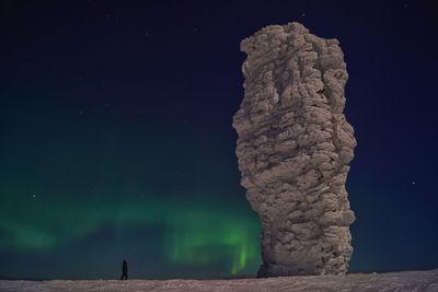
Manpupuner rock formations, Rock formations in Komi Republic, Russia.

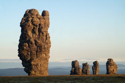
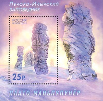
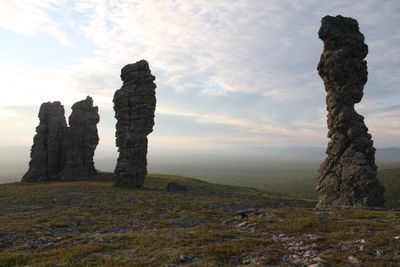
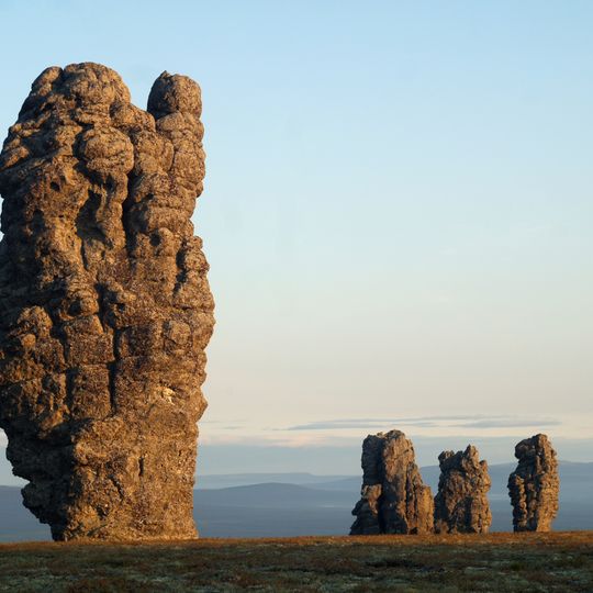
Manpupuner is a group of seven stone pillars on a high plateau in the Komi Republic, Russia. The rocks stand between 30 and 42 meters (98 and 138 feet) tall and display different profiles through natural weathering over millions of years.

Wind and water shaped these pillars from harder rock while softer layers of the surroundings disappeared over millions of years. The rocks are remnants of a mountain range that stood here about 200 million years ago.

The Mansi call these stone pillars by names such as warriors or gods and tell stories about petrified giants from ancient times. Hikers often notice the particular silence around the rocks, which are still respected as a sacred place today.

Access requires a multi-day guided expedition with hiking through forests and across open terrain. Weatherproof clothing and sufficient supplies are necessary since the nearest settlements are far away.

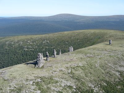
Six pillars stand on the flat plateau while the seventh stands somewhat apart near the edge. The shape of an inverted bottle is particularly noticeable in the tallest pillar and often serves visitors as a landmark.

The community of curious travelers

AroundUs brings together thousands of curated places, local tips, and hidden gems, enriched daily by 60,000 contributors worldwide.

Start exploring
Location
GPS coordinates
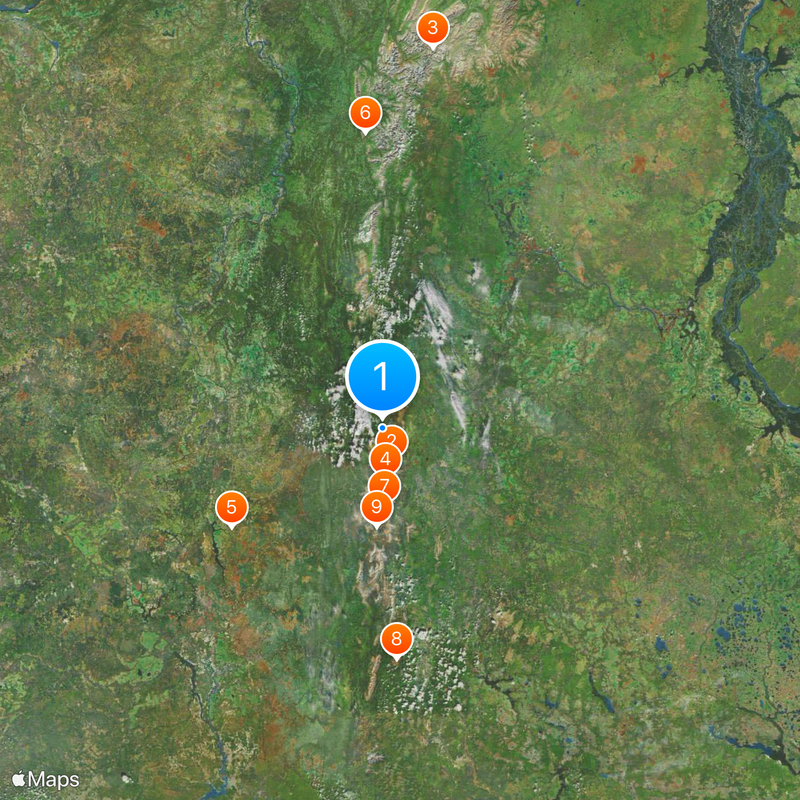
62.25949,59.29400
Latest update
September 16, 2026 16:30
Around this place
Dyatlov Pass
Russian Federation

Dyatlov Pass

35.3 mi
Kholat Syakhl
Russian Federation

Kholat Syakhl

35.2 mi
Otorten
Russian Federation

Otorten

27.6 mi
Vishera Nature Reserve
Russian Federation

Vishera Nature Reserve

53.7 mi
Puramunitur
Russian Federation

Puramunitur

40.8 mi
Russian Federation

Граница трёх регионов и трёх федеральных округов

41.3 mi
Russian Federation

Крест

67.3 mi
Russian Federation

Чистоп

54.7 mi
Russian Federation

The source of the Pechora River

5.8 mi
Russian Federation

Европа/Азия

16.5 mi
Russian Federation

Знак "главная дорога"

9.1 mi
Russian Federation

Знак Европа - Азия

6.4 mi
Russian Federation

Manpupuner rock formations

340 ft
Russian Federation

Ворота Отортена

27.4 mi
Russian Federation

Большие мансийские болваны (северная группа из 7 останцов)

330 ft
Russian Federation

Сарай Олега

25.2 mi
Russian Federation

Кратер

34.5 mi
Russian Federation

Шаман гора

67.1 mi
Russian Federation

Скала Кабан

53.7 mi
Russian Federation

Сарай Олега

25.2 mi
Russian Federation

Barrel

8.2 mi
Russian Federation

Шатуны

34.9 mi
Russian Federation

Маньпупунёр

0.4 mi
Russian Federation

Scenic viewpoint

170 ft
Russian Federation

Scenic viewpoint

62.1 mi
Russian Federation

Кедр, у которого нашли часть группы Дятлова

34.6 mi
Russian Federation

Tomb

25.2 mi
Russian Federation

Водопад урочища Йети

34.6 mi
Show the full map
Reviews
Share your experience

No review yet

Discussions
Start a discussion...

No discussion yet

« Manpupuner rock formations - Rock formations in Komi Republic, Russia » is provided by Around Us (aroundus.com). Images and texts are derived from Wikimedia project under a Creative Commons license. You are allowed to copy, distribute, and modify copies of this page, under the conditions set by the license, as long as this note is clearly visible.

Discover hidden gems everywhere you go!

From secret cafés to breathtaking viewpoints, skip the crowded tourist spots and find places that match your style. Our app makes it easy with voice search, smart filtering, route optimization, and insider tips from travelers worldwide. Download now for the complete mobile experience.

Around Us App Screenshot
❝

A unique approach to discovering new places❞

— Le Figaro

❝

All the places worth exploring❞

— France Info

❝

A tailor-made excursion in just a few clicks❞

— 20 Minutes

Around Us
Travel Guide & Maps
Download

Send to your phone

QR Code
1

Open the camera app on your mobile.

2

Point at the QR code with your camera. A notification will appear.

3

Tap the notification to open the link.