Сельское поселение «Село Аян»

Log in to your account

AroundUs is a community-driven map of interesting places, built by curious explorers like you. It grows with every review, story, and photo you share.
Connect to save your favorite spots, contribute locations, and create personalized routes.
By continuing, you accept our Terms and Conditions and our Privacy Policy

Сельское поселение «Село Аян»

Add to collection
Map
Suggest a change
Share

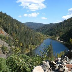
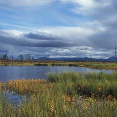
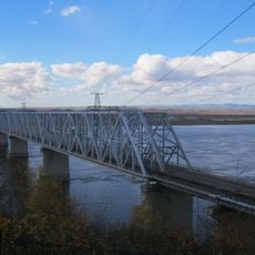
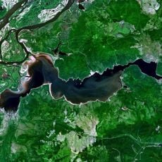
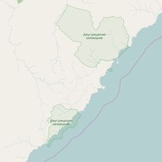
Сельское поселение «Село Аян», human settlement in Ayano-Maysky District, Khabarovsk Krai, Russia

GPS coordinates: 56.58246,137.93998

Latest update: March 13, 2025 21:00

Around this place
Show the full map
Lake Amut
Russian Federation

Lake Amut

650.7 km
Magadan Nature Reserve
Russian Federation

Magadan Nature Reserve

653.8 km
Komsomolsk-on-Amur road-rail bridge
Russian Federation

Komsomolsk-on-Amur road-rail bridge

682.7 km
Lake Bolshoe Kizi
Russian Federation

Lake Bolshoe Kizi

576.2 km
Bureya Nature Reserve
Russian Federation

Bureya Nature Reserve

561.6 km
Dzhugdzursky Nature Reserve
Russian Federation

Dzhugdzursky Nature Reserve

61.2 km
Shantar Islands National Park
Russian Federation

Shantar Islands National Park

178.3 km
Bureinsky Ridge
Russian Federation

Bureinsky Ridge

628.4 km
Yongning Temple Stele
Russian Federation

Yongning Temple Stele

421.9 km
Komsomolsk Nature Reserve
Russian Federation

Komsomolsk Nature Reserve

642.7 km
Nora Nature Reserve
Russian Federation

Nora Nature Reserve

670.3 km
Three Brothers Islands
Russian Federation

Three Brothers Islands

689.9 km
Lake Bolshoye Toko
Russian Federation

Lake Bolshoye Toko

439.2 km
Lake Evoron
Russian Federation

Lake Evoron

574.7 km
Силинский лес
Russian Federation

Силинский лес

671.4 km
Tokinsko-Stanovoy National Park
Russian Federation

Tokinsko-Stanovoy National Park

498.7 km
Lake Udyl
Russian Federation

Lake Udyl

509.9 km
Kyuryulyur
Russian Federation

Kyuryulyur

719.8 km
Памятник воинам-землякам, участникам Великой Отечественной войны (Петровка, Якутия)
Russian Federation

Памятник воинам-землякам, участникам Великой Отечественной войны (Петровка, Якутия)

720.4 km
Памятник-часовня (Петровка)
Russian Federation

Памятник-часовня (Петровка)

720.3 km
Orthodox cathedral of Saint Elijah the Prophet in Komsomolsk-on-Amur
Russian Federation

Orthodox cathedral of Saint Elijah the Prophet in Komsomolsk-on-Amur

670 km
Drama Theatre of Komsomolsk-on-Amur
Russian Federation

Drama Theatre of Komsomolsk-on-Amur

676 km
Gora Burgalenzha
Russian Federation

Gora Burgalenzha

368.9 km
Gora Yuzhnyy Krest
Russian Federation

Gora Yuzhnyy Krest

351.1 km
Dvorets Kultury
Russian Federation

Dvorets Kultury

710.6 km
Berkut Platform

Berkut Platform

588 km
Dom Kultury Stroiteley
Russian Federation

Dom Kultury Stroiteley

674.3 km
Zeya Reservoir
Russian Federation

Zeya Reservoir

714.7 km
Show the full map

Reviews

Visited this place? Tap the stars to rate it and share your experience / photos with the community! Try now! You can cancel it anytime.

« Сельское поселение «Село Аян» - human settlement in Ayano-Maysky District, Khabarovsk Krai, Russia » is provided by Around Us (aroundus.com). Images and texts are derived from Wikimedia project under a Creative Commons license. You are allowed to copy, distribute, and modify copies of this page, under the conditions set by the license, as long as this note is clearly visible.

Discover hidden gems everywhere you go!

From secret cafés to breathtaking viewpoints, skip the crowded tourist spots and find places that match your style. Our app makes it easy with voice search, smart filtering, route optimization, and insider tips from travelers worldwide. Download now for the complete mobile experience.

Around Us App Screenshot

A unique approach to discovering new places

Le Figaro

All the places worth exploring

France Info

A tailor-made excursion in just a few clicks

20 Minutes