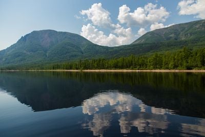
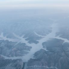
Lake Bolshoye Toko, Protected lake in Sakha Republic, Russia.
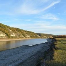
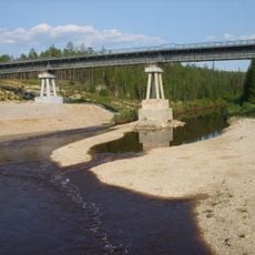
Lake Bolshoye Toko is a deep water body situated in the Aldan Highlands with steep shores and clear waters. Its landscape features surrounding forests and connects to the wider Uchur basin through the Mulam River system.
This water body formed through natural geological processes over time and fundamentally shaped the region's geography. It historically served as a natural dividing line between different administrative territories and lands.
The lake holds importance in the daily life of local communities, who have long depended on its waters for food and survival.
Reaching this location requires specialized transport due to its remote setting in the Sakha Republic. Visitors should prepare for harsh weather and check local conditions before planning a trip.
This water body holds the distinction of being the deepest lake in Yakutia, remarkable for such extreme depth in this isolated region. This characteristic makes it hydrographically significant and contributes to its scientific importance.
Location: Sakha
Elevation above the sea: 903 m
GPS coordinates: 56.05611,130.88583
Latest update: December 12, 2025 09:04
Lena Pillars
598.1 km
Zeya Dam
342.3 km
Highland of Aldan
388.8 km
Olyokma Nature Reserve
592.8 km
Zeya Nature Reserve
323.3 km
Bureya Nature Reserve
519.4 km
Dzhugdzursky Nature Reserve
466.5 km
Shantar Islands National Park
432.8 km
Bureinsky Ridge
571.7 km
Nora Nature Reserve
397.6 km
Buotama
572 km
Tokinsko-Stanovoy National Park
70.7 km
Kyuryulyur
600.8 km
Памятник воинам-землякам, погибшим в годы Великой Отечественной войны (Томмот)
426 km
Мемориал Славы (Нерюнгри)
387.1 km
Orthodox church of the New Martyrs and Confessors of Russia in Aldan
436 km
Gora Burgalenzha
122.4 km
Road bridge over Aldan River in Tommot
424.8 km
Railway bridge through Amga river in Verkhnyaya Amga
457.8 km
Railway bridge through Aldan river in Tommot
424.9 km
Gora Yuzhnyy Krest
105.6 km
Railway bridge through Lyutenge river
566.5 km
Road bridge over Amga River in Verkhnyaya Amga
457.7 km
Railway bridge through Kirim river
585.3 km
Rail bridge over Ulu river
515.7 km
Railway bridge through Lyutenge river
600.7 km
Road bridge over Ulu River in Ulu
515.4 km
Zeya Reservoir
311 kmVisited this place? Tap the stars to rate it and share your experience / photos with the community! Try now! You can cancel it anytime.
Discover hidden gems everywhere you go!
From secret cafés to breathtaking viewpoints, skip the crowded tourist spots and find places that match your style. Our app makes it easy with voice search, smart filtering, route optimization, and insider tips from travelers worldwide. Download now for the complete mobile experience.
A unique approach to discovering new places❞
— Le Figaro
All the places worth exploring❞
— France Info
A tailor-made excursion in just a few clicks❞
— 20 Minutes